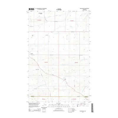
2014 Map of Dupuyer East
USGS Topo · Published 2014About this map
Birch Creek Colony stands as a focal point in this portion of the northern Montana plains, situated along the banks of Birch Creek. This agricultural landscape is defined by its sophisticated water management systems, including the B Canal, D Canal, and B Four Ditch, which redirect water across the arid terrain. The settlement of Dupuyer serves as a local hub near the western edge, positioned where Us-89 intersects the drainage of Dupuyer Cr. The terrain is deeply etched by a series of coulees such as Hay Coulee, Woods Coulee, and Jensen Coulee, showing the complex drainage patterns feeding into the Middle Fork Dry Fork Marias River. The boundary between Pondera and Teton counties cuts across the southern reach of the survey, marking a transition in local jurisdiction amidst a network of rural roads like Conrad-Dupuyer Rd and Gypsy Basin Rd.
Find a feature on this map
32 named features on this map. Tap any name to fly to it.
Don’t see what you’re looking for? This feature index may not catch every label — zoom into the map to look around manually.
Map Details
Editions of this 2014 Dupuyer East Map
This is the sole edition of this map. No revisions or reprints were ever made.
Other maps of this area

1914 · Heart Butte
USGS Topo · 1:125,000

1918 · Heart Butte
USGS Topo · 1:125,000

1920 · Dupuyer
USGS Topo · 1:125,000

1934 · Lake Frances
USGS Topo · 1:48,000

1936 · Pendroy
USGS Topo · 1:48,000

1937 · Lake Frances
USGS Topo · 1:62,500

1941 · Pendroy
USGS Topo · 1:62,500

1960 · Cut Bank
USGS Topo · 1:250,000

1963 · Cut Bank
USGS Topo · 1:250,000

1964 · Cut Bank
USGS Topo · 1:250,000
Featured Places
- Birch Creek Hutterite Colony, MT
- Pondera Hutterite Colony, MT
- Teton County, MT
- Pondera County, MT
- United States