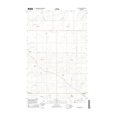
2017 Map of Dupuyer East
USGS Topo · Published 2017About this map
Dupuyer serves as the primary settlement within this northern Montana landscape, where the agricultural life of the plains meets a complex network of water management. The terrain is defined by the three branches of the Marias River—the N Fork Dry Fork Marias River, Middle Fork Dry Fork Marias River, and S Fork Dry Fork Marias River. These waterways are supplemented by an extensive system of man-made irrigation, including the B Canal, B Four Ditch, and D Canal, illustrating the vital role of water rights and engineering in this semi-arid region. North of the Pondera and Teton County line, the map traces the drainage patterns of numerous coulees such as Hay Coulee and Woods Coulee. Local infrastructure is marked by rural thoroughfares like Birch Creek Colony Rd and Gypsy Basin Rd, which connect remote homesteads and ranching interests to the hub at Dupuyer.
Find a feature on this map
32 named features on this map. Tap any name to fly to it.
Don’t see what you’re looking for? This feature index may not catch every label — zoom into the map to look around manually.
Map Details
Editions of this 2017 Dupuyer East Map
This is the sole edition of this map. No revisions or reprints were ever made.
Other maps of this area

1914 · Heart Butte
USGS Topo · 1:125,000

1918 · Heart Butte
USGS Topo · 1:125,000

1920 · Dupuyer
USGS Topo · 1:125,000

1934 · Lake Frances
USGS Topo · 1:48,000

1936 · Pendroy
USGS Topo · 1:48,000

1937 · Lake Frances
USGS Topo · 1:62,500

1941 · Pendroy
USGS Topo · 1:62,500

1960 · Cut Bank
USGS Topo · 1:250,000

1963 · Cut Bank
USGS Topo · 1:250,000

1964 · Cut Bank
USGS Topo · 1:250,000
Featured Places
- Birch Creek Hutterite Colony, MT
- Pondera Hutterite Colony, MT
- Teton County, MT
- Pondera County, MT
- United States