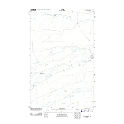
2011 Map of Dupuyer West
USGS Topo · Published 2011About this map
Dupuyer serves as the primary hub for this Pondera County landscape, situated where the high plains meet the intricate drainage systems of the eastern Rockies. The map documents a sophisticated irrigation and water management network essential to the region's ranching economy, including the extensive B Canal, the Dean Burd Leach Ditch, and the Scott Ranch Dam. These man-made features overlay a natural hydrography of seasonal coulees and fork systems, such as Jones Coulee and Sober Up Coulee.
Find a feature on this map
18 named features on this map. Tap any name to fly to it.
Don’t see what you’re looking for? This feature index may not catch every label — zoom into the map to look around manually.
Map Details
Editions of this 2011 Dupuyer West Map
This is the sole edition of this map. No revisions or reprints were ever made.
Other maps of this area

1914 · Heart Butte
USGS Topo · 1:125,000

1918 · Heart Butte
USGS Topo · 1:125,000

1920 · Dupuyer
USGS Topo · 1:125,000

1934 · Lake Frances
USGS Topo · 1:48,000

1936 · Pendroy
USGS Topo · 1:48,000

1937 · Lake Frances
USGS Topo · 1:62,500

1941 · Pendroy
USGS Topo · 1:62,500

1960 · Cut Bank
USGS Topo · 1:250,000

1963 · Cut Bank
USGS Topo · 1:250,000

1964 · Cut Bank
USGS Topo · 1:250,000