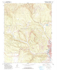
1963 Map of Durango West
USGS Topo · Published 1993About this map
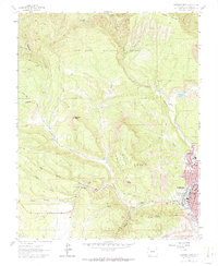
Durango anchors the eastern edge of this 1963 survey, where early residential developments like Mountview Pkwy and Westview Dr meet the steep western foothills of the San Juan Mountains. The landscape is a study in resource extraction and water management, evidenced by the Big Stick Ditch and a cluster of coal operations along Coal Gulch, including the Victory Mine and Boston Mine. These mines are connected by an Old Railroad Grade that winds through the drainage of Lightner Creek, illustrating the era's transition from heavy industry to protected wilderness. To the west, the Perins Peak State Wildlife Area encompasses landmarks like Barnroof Point and Twin Buttes, while the southern slopes of Smelter Mountain overlook the city. This map captures the community just as it was expanding past its mining roots toward Miller Jr High Sch and the Green Mountain Cemetery.
Find a feature on this map
50 named features on this map. Tap any name to fly to it.
Don’t see what you’re looking for? This feature index may not catch every label — zoom into the map to look around manually.
Map Details
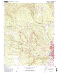
Editions of this 1963 Durango West Map
6 editions found
Other maps of this area

1895 · La Plata
USGS Topo · 1:62,500

1897 · La Plata
USGS Topo · 1:62,500

1898 · Durango
USGS Topo · 1:62,500

1899 · La Plata
USGS Topo · 1:62,500

1907 · Durango
USGS Topo · 1:62,500

1908 · Ignacio
USGS Topo · 1:125,000

1908 · Durango
USGS Topo · 1:62,500

1908 · La Plata
USGS Topo · 1:62,500

1913 · Red Mesa
USGS Topo · 1:62,500

1924 · Ignacio
USGS Topo · 1:125,000