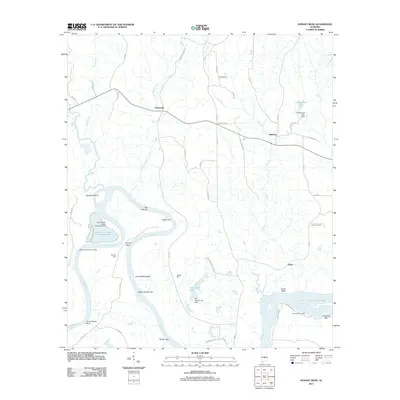
2011 Map of Durant Bend
USGS Topo · Published 2011About this map
Alabama River sandbars and bluffs define this portion of the coastal plain as it appeared in the early 21st century. The river snakes through the center of the sheet, depositing several named bars such as Old Hell Bar, Gaston Bar, and Morgan Bar, while creating high ground at Cunningham Bluff and Jones Bluff. Settlement is concentrated in the small communities of Statesville, Mulberry, and Peace, with the surrounding landscape marked by timber and agriculture as evidenced by Steezers Farm and Steeles Farm. Industrial activity is centered on the riverbank, notably at the Alabama State Docks Facility and the large Hammermill Waste Treatment Pond near Gardiner Island. The creek systems of Buck Creek, Mulberry Creek, and Ivy Creek feed into the main river channel, supporting small reservoirs like Underwood Lake and Jim Adams Lake near the eastern hills.
Find a feature on this map
57 named features on this map. Tap any name to fly to it.
Don’t see what you’re looking for? This feature index may not catch every label — zoom into the map to look around manually.
Map Details
Editions of this 2011 Durant Bend Map
This is the sole edition of this map. No revisions or reprints were ever made.
Other maps of this area

1891 · Clanton
USGS Topo · 1:125,000

1953 · Montgomery
USGS Topo · 1:250,000

1956 · Montgomery
USGS Topo · 1:250,000

1957 · Montgomery
USGS Topo · 1:250,000

1957 · Autaugaville
USGS Topo · 1:62,500

1957 · Benton
USGS Topo · 1:62,500

1959 · Plantersville
USGS Topo · 1:62,500

1959 · Billingsley
USGS Topo · 1:62,500

1975 · Benton SE
USGS Topo · 1:24,000

1975 · Autaugaville SW
USGS Topo · 1:24,000