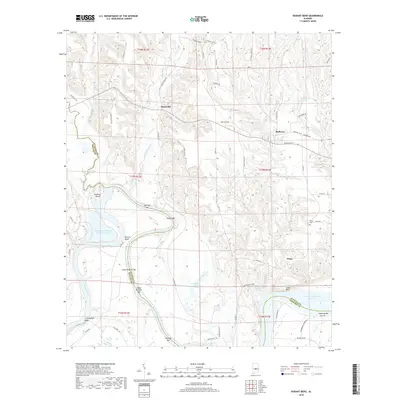
2018 Map of Durant Bend
USGS Topo · Published 2018About this map
The Alabama River carves a winding path through the borderlands of Autauga, Dallas, and Lowndes counties, defining the landscape around Statesville and Mulberry. This part of the Black Belt is characterized by its wide river bends and the broad R E 'Bob' Woodruff Reservoir, which significantly altered the local drainage patterns compared to earlier eras. Away from the water, the settlement of Peace and landmarks like Jones Cem provide anchor points for genealogical study. The river itself is dotted with named bars and islands, such as Old Hell Bar and Gardiner Island, reflecting a long history of river navigation and sandbar identification. The terrain transitions from the low-lying wetlands of the Hammermill Waste Treatment Pond to the elevated outlooks at Jones Bluff and Cunningham Bluff, illustrating the varying geography that supported the region's agricultural and timber interests.
Find a feature on this map
63 named features on this map. Tap any name to fly to it.
Don’t see what you’re looking for? This feature index may not catch every label — zoom into the map to look around manually.
Map Details
Editions of this 2018 Durant Bend Map
This is the sole edition of this map. No revisions or reprints were ever made.
Other maps of this area

1891 · Clanton
USGS Topo · 1:125,000

1953 · Montgomery
USGS Topo · 1:250,000

1956 · Montgomery
USGS Topo · 1:250,000

1957 · Montgomery
USGS Topo · 1:250,000

1957 · Autaugaville
USGS Topo · 1:62,500

1957 · Benton
USGS Topo · 1:62,500

1959 · Plantersville
USGS Topo · 1:62,500

1959 · Billingsley
USGS Topo · 1:62,500

1975 · Benton SE
USGS Topo · 1:24,000

1975 · Autaugaville SW
USGS Topo · 1:24,000