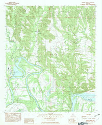
1982 Map of Durant Bend
USGS Topo · Published 1982About this map
Alabama River waters dominate this 1982 survey, defining the sweeping curve of Durant Bend and the surrounding riverine landscape. The river serves as a major industrial and transit artery, evidenced by the State Dock, a Boat Ramp, and several riverfront landings such as Steels Landing and Henderson Ldg. To the east, the impounded waters of Woodruff (Bob) Lake press against Jones Bluff, marking a transition from free-flowing river to reservoir.
Find a feature on this map
28 named features on this map. Tap any name to fly to it.
Don’t see what you’re looking for? This feature index may not catch every label — zoom into the map to look around manually.
Map Details
Editions of this 1982 Durant Bend Map
This is the sole edition of this map. No revisions or reprints were ever made.
Other maps of this area

1891 · Clanton
USGS Topo · 1:125,000

1953 · Montgomery
USGS Topo · 1:250,000

1956 · Montgomery
USGS Topo · 1:250,000

1957 · Montgomery
USGS Topo · 1:250,000

1957 · Autaugaville
USGS Topo · 1:62,500

1957 · Benton
USGS Topo · 1:62,500

1959 · Plantersville
USGS Topo · 1:62,500

1959 · Billingsley
USGS Topo · 1:62,500

1975 · Benton SE
USGS Topo · 1:24,000

1975 · Autaugaville SW
USGS Topo · 1:24,000