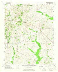
1964 Map of Durhamville
USGS Topo · Published 1965About this map
Durhamville and the surrounding rural community sit along the border of Haywood and Lauderdale counties in West Tennessee. In the mid-1960s, this landscape was defined by an intricate network of local roads such as Nunn Road, Cox Road, and Lebanon Road, which connected a series of family and community focal points. The map reveals a high density of country churches and associated burial grounds, including Greater Zion Ch and Durham Cem, reflecting the deep-rooted settlement patterns of the area.
Find a feature on this map
30 named features on this map. Tap any name to fly to it.
Don’t see what you’re looking for? This feature index may not catch every label — zoom into the map to look around manually.
Map Details
Editions of this 1964 Durhamville Map
2 editions found
Other maps of this area

1939 · Hales Point
USGS Topo · 1:62,500

1939 · Halls
USGS Topo · 1:62,500

1950 · Brownsville
USGS Topo · 1:24,000

1951 · Brownsville
USGS Topo · 1:24,000

1952 · Hales Point
USGS Topo · 1:62,500

1952 · Gates
USGS Topo · 1:24,000

1952 · Chestnut Bluff
USGS Topo · 1:24,000

1956 · Blytheville
USGS Topo · 1:250,000

1959 · Blytheville
USGS Topo · 1:250,000

1961 · Hales Point
USGS Topo · 1:62,500