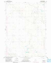
1960 Map of Duroc
USGS Topo · Published 1991About this map
Agricultural water management in Goshen County is the defining characteristic of this 1960s landscape, illustrating the intricate network of irrigation vital to the Missouri River Basin development. The Fort Laramie Canal cuts across the northern terrain, supplemented by the Hawk Springs Ditch and Lewis Ditch to divert water from natural channels like Horse Creek. These man-made improvements, alongside the Pockett Main Drain and Mc Elroy Drain, demonstrate the intensive engineering required to sustain ranching and farming in this high-plains environment.
Find a feature on this map
12 named features on this map. Tap any name to fly to it.
Don’t see what you’re looking for? This feature index may not catch every label — zoom into the map to look around manually.
Map Details
Editions of this 1960 Duroc Map
3 editions found
Other maps of this area

1899 · Goshen Hole
USGS Topo · 1:125,000

1954 · Cheyenne
USGS Topo · 1:250,000

1958 · Cheyenne
USGS Topo · 1:250,000

1960 · Huntley
USGS Topo · 1:24,000

1960 · Mc Compsey Pass
USGS Topo · 1:24,000

1960 · Hawk Springs
USGS Topo · 1:24,000

1960 · Lyman
USGS Topo · 1:24,000

1960 · Kessler Gap
USGS Topo · 1:24,000

1960 · La Grange
USGS Topo · 1:24,000
1960 · Duroc
USGS Topo · 1:24,000