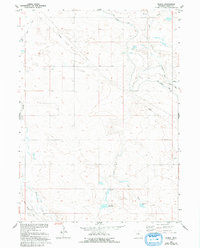
1960 Map of Duroc
USGS Topo · Published 1993About this map
Horse Creek and its associated irrigation infrastructure define this landscape in Goshen County, captured in a survey initially field-checked in 1960. The map reveals an intricate network of water management essential for high-plains agriculture, featuring the Fort Laramie Canal and several specialized channels such as the Lewis Ditch, Duroc Ditch, and the Crockett Main Drain. These human-made alterations to the drainage system reflect the intense land use during the mid-20th-century development of the Missouri River Basin.
Find a feature on this map
22 named features on this map. Tap any name to fly to it.
Don’t see what you’re looking for? This feature index may not catch every label — zoom into the map to look around manually.
Map Details
Editions of this 1960 Duroc Map
3 editions found
Other maps of this area

1899 · Goshen Hole
USGS Topo · 1:125,000

1954 · Cheyenne
USGS Topo · 1:250,000

1958 · Cheyenne
USGS Topo · 1:250,000

1960 · Huntley
USGS Topo · 1:24,000

1960 · Mc Compsey Pass
USGS Topo · 1:24,000

1960 · Hawk Springs
USGS Topo · 1:24,000

1960 · Lyman
USGS Topo · 1:24,000

1960 · Kessler Gap
USGS Topo · 1:24,000

1960 · La Grange
USGS Topo · 1:24,000
1960 · Duroc
USGS Topo · 1:24,000