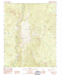
1987 Map of Durrwood Creek
USGS Topo · Published 1994About this map
The Kern River carves a deep valley through this portion of the Sequoia National Forest, defining the landscape of Tulare County during the late 1980s. Steep canyon walls rise toward prominent high-altitude markers such as The Needles and Needlerock to the west, while Schaeffer Mountain and Sherman Peak dominate the eastern reaches. The map documents a network of seasonal camps and specialized infrastructure, including Durrwood Camp, Bean Camp, and a Cable Crossing over the river, illustrating the area's role as a base for wilderness recreation and forest management.
Find a feature on this map
31 named features on this map. Tap any name to fly to it.
Don’t see what you’re looking for? This feature index may not catch every label — zoom into the map to look around manually.
Map Details
Editions of this 1987 Durrwood Creek Map
2 editions found
Other maps of this area

1904 · Kaweah
USGS Topo · 1:125,000

1905 · Olancha
USGS Topo · 1:125,000

1905 · Fairview
USGS Topo · 1:24,000

1906 · Kernville
USGS Topo · 1:125,000

1907 · Olancha
USGS Topo · 1:125,000

1908 · Kernville
USGS Topo · 1:125,000

1909 · Kaweah
USGS Topo · 1:125,000

1918 · Fairview
USGS Topo · 1:31,680

1936 · Tobias Peak
USGS Topo · 1:125,000

1937 · Kaweah
USGS Topo · 1:125,000