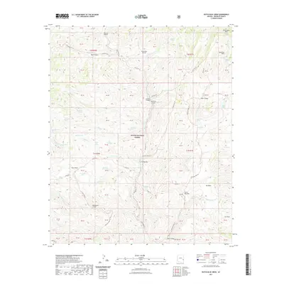
2021 Map of Dutch Blue Creek
USGS Topo · Published 2021About this map
The Blue River carves a deep path through the canyonlands of Apache National Forest, defining a landscape where water sources were the primary anchors for travel and activity. Named springs and tanks are scattered throughout the drainages, from Dead Mule Spring to the thermal waters of Hannah Hot Spring. This remote corridor was navigated by an intricate network of livestock and pack trails, including the Strayhorse Trl and the Cow Flat Trl, which connect high ground like Paint Rock Prairie and Government Mesa to the river floor.
Find a feature on this map
92 named features on this map. Tap any name to fly to it.
Don’t see what you’re looking for? This feature index may not catch every label — zoom into the map to look around manually.
Map Details
Editions of this 2021 Dutch Blue Creek Map
This is the sole edition of this map. No revisions or reprints were ever made.
Other maps of this area

1913 · Morenci
USGS Topo · 1:125,000

1915 · Morenci
USGS Topo · 1:125,000

1922 · Nutrioso
USGS Topo · 1:125,000

1954 · Clifton
USGS Topo · 1:250,000

1957 · Clifton
USGS Topo · 1:250,000

1958 · Clifton
USGS Topo · 1:250,000

1958 · Hannagan Meadow
USGS Topo · 1:62,500

1961 · Blue
USGS Topo · 1:62,500

1962 · Clifton
USGS Topo · 1:250,000
1967 · Alma Mesa
USGS Topo · 1:24,000