
1969 Map of Dutch Henry Coulee
USGS Topo · Published 1972About this map
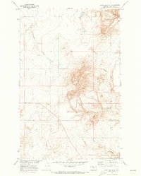
The Marias River carves a deep, winding path through this northern Montana landscape, defining the northern and eastern reaches of the territory. The terrain is dominated by high-plains topography dissected by significant drainage systems, most notably Dutch Henry Coulee and Fourmile Coulee. These coulees create a complex network of breaks and ridges that contrast sharply with the flatter tablelands. Human presence is sparse, centered primarily around the small settlement of Shepard, located in the western portion of the quadrangle. The map also delineates the administrative boundary between Hill County and Chouteau County, which runs through the center of the survey. This 1969 field check captures the area's transition from open range to documented cadastral units, showing the section lines and fence lines that had begun to organize the cattle country and dryland farm acreage of the era.
Find a feature on this map
5 named features on this map. Tap any name to fly to it.
Don’t see what you’re looking for? This feature index may not catch every label — zoom into the map to look around manually.
Map Details
Editions of this 1969 Dutch Henry Coulee Map
This is the sole edition of this map. No revisions or reprints were ever made.
Other maps of this area

1954 · Shelby
USGS Topo · 1:250,000

1958 · Shelby
USGS Topo · 1:250,000
1964 · Day School SW
USGS Topo · 1:24,000
1964 · Day School
USGS Topo · 1:24,000
1969 · Discovery Butte
USGS Topo · 1:24,000

1970 · Penzer School
USGS Topo · 1:24,000
1970 · Rocky Coulee SE
USGS Topo · 1:24,000

1970 · Poverty Coulee SE
USGS Topo · 1:24,000

1970 · Rocky Coulee SW
USGS Topo · 1:24,000
1970 · Goose Bill Butte
USGS Topo · 1:24,000