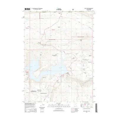
2014 Map of Dutch John
USGS Topo · Published 2014About this map
Dutch John sits as a primary settlement within the Ashley National Forest, serving as a gateway to the massive Flaming Gorge Reservoir. This 2014 survey documents a landscape defined by dramatic elevation changes, from the sheer Blacktail Cliff to the high Dutch John Mtn. The infrastructure of the area is centered on water and recreation, featuring the Flaming Gorge Lodge and the Flaming Gorge Summer Home Area to the south. Transportation is anchored by US Hwy 191, which crosses the water via the Cart Creek Bridge. Nearby, the Dutch John Airport and various forest roads like Little Hole Rd and Goslin Mountain Rd provide access to the rugged plateaus of Alabama Flat and Dutch John Bench. The presence of the Greendale Canal and several isolated springs, such as Jarvies Spring, highlights the critical management of water in this high-desert environment.
Find a feature on this map
53 named features on this map. Tap any name to fly to it.
Don’t see what you’re looking for? This feature index may not catch every label — zoom into the map to look around manually.
Map Details
Editions of this 2014 Dutch John Map
This is the sole edition of this map. No revisions or reprints were ever made.
Other maps of this area

1885 · Ashley
USGS Topo · 1:250,000

1906 · Marsh Peak
USGS Topo · 1:125,000

1908 · Marsh Peak
USGS Topo · 1:125,000

1952 · Dutch John Mtn
USGS Topo · 1:24,000

1952 · Goslin Mtn
USGS Topo · 1:24,000

1952 · Flaming Gorge
USGS Topo · 1:24,000

1954 · Vernal
USGS Topo · 1:250,000

1954 · Rock Springs
USGS Topo · 1:250,000

1957 · Currant Creek Ranch
USGS Topo · 1:62,500

1958 · Vernal
USGS Topo · 1:250,000
Featured Places
- Flaming Gorge Summer Home Area, UT
- Dutch John, UT
- Sweetwater County, WY
- Daggett County, UT
- United States