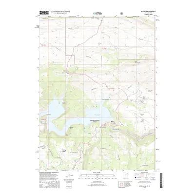
2017 Map of Dutch John
USGS Topo · Published 2017About this map
Dutch John serves as the central hub of this Daggett County landscape, situated near the dramatic banks of the Flaming Gorge Reservoir. The terrain is defined by a series of named flats and benches, including Dutch John Flat and Dutch John Bench, which overlook the complex system of canyons and draws feeding into the Green River. Within the Ashley National Forest, the map details a network of early ranching and recreational infrastructure, notably the Swett Ranch and its associated Swett Ranch Ski Trail in the southwest.
Find a feature on this map
51 named features on this map. Tap any name to fly to it.
Don’t see what you’re looking for? This feature index may not catch every label — zoom into the map to look around manually.
Map Details
Editions of this 2017 Dutch John Map
This is the sole edition of this map. No revisions or reprints were ever made.
Other maps of this area

1885 · Ashley
USGS Topo · 1:250,000

1906 · Marsh Peak
USGS Topo · 1:125,000

1908 · Marsh Peak
USGS Topo · 1:125,000

1952 · Dutch John Mtn
USGS Topo · 1:24,000

1952 · Goslin Mtn
USGS Topo · 1:24,000

1952 · Flaming Gorge
USGS Topo · 1:24,000

1954 · Vernal
USGS Topo · 1:250,000

1954 · Rock Springs
USGS Topo · 1:250,000

1957 · Currant Creek Ranch
USGS Topo · 1:62,500

1958 · Vernal
USGS Topo · 1:250,000
Featured Places
- Flaming Gorge Summer Home Area, UT
- Dutch John, UT
- Sweetwater County, WY
- Daggett County, UT
- United States