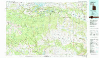
1981 Map of Dutch John
USGS Topo · Published 1982About this map
Flaming Gorge Reservoir dominates the northern landscape of this 1981 survey, where the Green River carves through the high plateau country of the Uinta Mountains. The map documents a region of intensive federal land management, showing the extensive reaches of the Ashley National Forest and the Flaming Gorge National Recreation Area. Small settlements like Manila, Dutch John, and Greendale serve as hubs in a terrain defined by dramatic elevation changes, from the Lucerne Valley to the heights of Mosby Mountain.
Find a feature on this map
61 named features on this map. Tap any name to fly to it.
Don’t see what you’re looking for? This feature index may not catch every label — zoom into the map to look around manually.
Map Details
Editions of this 1981 Dutch John Map
2 editions found
Other maps of this area

1885 · Ashley
USGS Topo · 1:250,000

1885 · Uinta
USGS Topo · 1:250,000

1905 · Gilbert Peak
USGS Topo · 1:125,000

1906 · Gilbert Peak
USGS Topo · 1:125,000

1906 · Marsh Peak
USGS Topo · 1:125,000

1907 · Rangely
USGS Topo · 1:125,000

1907 · Jensen
USGS Topo · 1:125,000

1908 · Marsh Peak
USGS Topo · 1:125,000

1910 · Jensen
USGS Topo · 1:125,000

1910 · Rangely
USGS Topo · 1:125,000