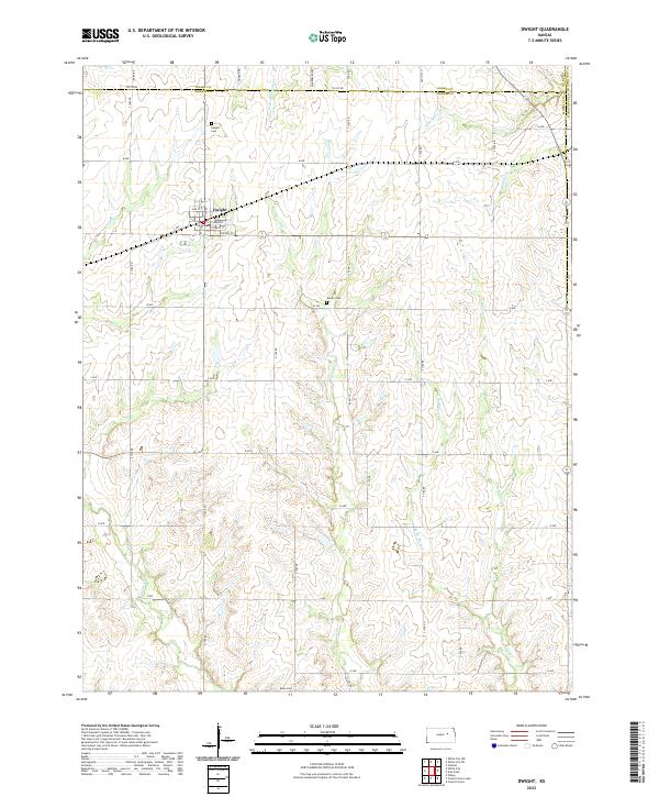
2022 Map of Dwight
USGS Topo · Published 2022About this map
Dwight sits at the northern edge of Morris County, established along a grid of streets including Main St and Cypress St. The surrounding landscape is defined by the branching headwaters of several creek systems that drain the undulating terrain of the eastern Kansas plains. To the north, W Br Mill Cr and W Br Humboldt Cr flow toward the Geary County line, while Munkers Cr and Slough Cr carve paths through the central and southern sections of the quadrangle. For those researching local families, the map identifies three distinct burial sites: Dwight Cem just north of the town site, Swartz Cem situated near D Ave, and Kelso Cem at the southern boundary. The network of section-line roads, such as Quaker Rd and Wandersee Rd, illustrates a persistent rural land pattern typical of the region's agricultural development.
Find a feature on this map
47 named features on this map. Tap any name to fly to it.
Don’t see what you’re looking for? This feature index may not catch every label — zoom into the map to look around manually.
Map Details
Editions of this 2022 Dwight Map
This is the sole edition of this map. No revisions or reprints were ever made.
Other maps of this area

1885 · Eskridge
USGS Topo · 1:125,000

1889 · Parkerville
USGS Topo · 1:125,000

1889 · Eskridge
USGS Topo · 1:125,000

1894 · Eskridge
USGS Topo · 1:125,000

1894 · Parkerville
USGS Topo · 1:125,000

1955 · Hutchinson
USGS Topo · 1:250,000

1959 · Hutchinson
USGS Topo · 1:250,000
1971 · Volland
USGS Topo · 1:24,000

1971 · Alta Vista
USGS Topo · 1:24,000
1971 · White City NW
USGS Topo · 1:24,000