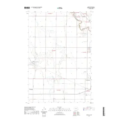
2020 Map of Dwight
USGS Topo · Published 2020About this map
The Wild Rice River meanders across the Red River Valley, carving a winding path through the agricultural landscape northwest of Wahpeton. This 2020 survey documents the rural character of the North Dakota-Minnesota border, where the Red River of the North defines the state line between Richland County and Wilkin County. Small settlements like Dwight, Brushvale, and Farmington serve as local anchors for the surrounding farmsteads.
Find a feature on this map
56 named features on this map. Tap any name to fly to it.
Don’t see what you’re looking for? This feature index may not catch every label — zoom into the map to look around manually.
Map Details
Editions of this 2020 Dwight Map
This is the sole edition of this map. No revisions or reprints were ever made.
Other maps of this area

1904 · Wahpeton
USGS Topo · 1:125,000

1953 · Fargo
USGS Topo · 1:250,000

1956 · Fargo
USGS Topo · 1:250,000

1960 · Galchutt
USGS Topo · 1:24,000

1960 · Mooreton East
USGS Topo · 1:24,000

1964 · Fairmount NW
USGS Topo · 1:24,000

1964 · Great Bend
USGS Topo · 1:24,000

1964 · Dwight
USGS Topo · 1:24,000

1964 · Wahpeton
USGS Topo · 1:24,000
1973 · Abercrombie
USGS Topo · 1:24,000