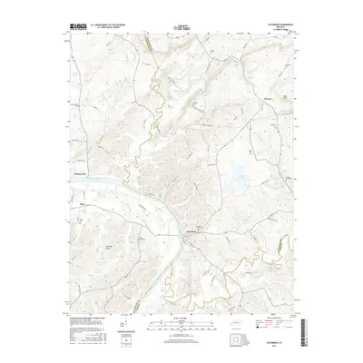
2016 Map of Dycusburg
USGS Topo · Published 2016About this map
Dycusburg and Pinckneyville anchor this survey of the riverlands where the Cumberland River winds through the borderlands of Livingston and Crittenden counties. The landscape is defined by the complex hydrography of the region, including the broad Cumberland River and numerous springs like Caldwell Spring and Doan Spring. This area maintains a strong connection to its early nineteenth-century settlement roots, evidenced by the high density of family and community burial grounds such as Asbridge Cem, Koons Cem, and Stevenson Cem. In the northeast, Whitt Bluff stands near the village of Frances, while the southern reaches are marked by the wetlands of Brushy Pond and the course of Livingston Cr. The network of backroads, including Brown Mines Rd and Paddys Bluff Rd, provides a clear view of the rural upland terrain and established property lines common in Western Kentucky.
Find a feature on this map
79 named features on this map. Tap any name to fly to it.
Don’t see what you’re looking for? This feature index may not catch every label — zoom into the map to look around manually.
Map Details
Editions of this 2016 Dycusburg Map
This is the sole edition of this map. No revisions or reprints were ever made.
Other maps of this area

1916 · Fords Ferry
USGS Topo · 1:62,500

1916 · Golconda
USGS Topo · 1:62,500

1920 · Goloonda
USGS Topo · 1:48,000

1921 · Fords Ferry
USGS Topo · 1:48,000

1921 · Golconda
USGS Topo · 1:62,500

1925 · Cave In Rock
USGS Topo · 1:62,500

1928 · Eddyville
USGS Topo · 1:48,000

1929 · Smithland
USGS Topo · 1:62,500

1931 · Eddyville
USGS Topo · 1:62,500

1936 · Eddyville
USGS Topo · 1:48,000