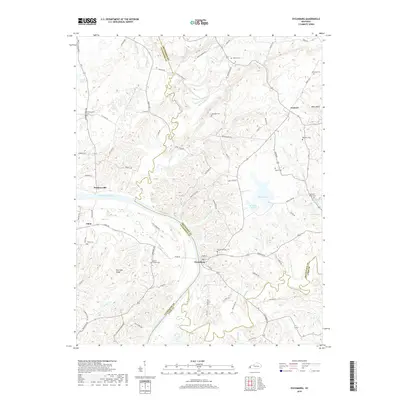
2019 Map of Dycusburg
USGS Topo · Published 2019About this map
The Cumberland River carves a deep path through this landscape, marking the boundary between Livingston and Crittenden Counties. This region is characterized by its numerous natural springs and small settlements that historically supported the local river-and-rail economy. The settlement of Dycusburg sits near the river's edge, anchored by Spring St and the Dycusburg Cem. The terrain rises to the west toward Post Oak Ridge and to the northeast at Whitt Bluff, with the landscape dotted by family-named cemeteries such as Mathews Cem, Owens Cem, and Asbridge Cem. The abundance of water sources, from Maple Lake to smaller features like Larping Spring and Bogard Spring, illustrates the hydrology that shaped these rural communities. Researchers can trace the network of country roads including Pinckneyville Rd and Tiline Rd connecting the outlying hamlets of Pinckneyville and Tiline.
Find a feature on this map
91 named features on this map. Tap any name to fly to it.
Don’t see what you’re looking for? This feature index may not catch every label — zoom into the map to look around manually.
Map Details
Editions of this 2019 Dycusburg Map
This is the sole edition of this map. No revisions or reprints were ever made.
Other maps of this area

1916 · Fords Ferry
USGS Topo · 1:62,500

1916 · Golconda
USGS Topo · 1:62,500

1920 · Goloonda
USGS Topo · 1:48,000

1921 · Fords Ferry
USGS Topo · 1:48,000

1921 · Golconda
USGS Topo · 1:62,500

1925 · Cave In Rock
USGS Topo · 1:62,500

1928 · Eddyville
USGS Topo · 1:48,000

1929 · Smithland
USGS Topo · 1:62,500

1931 · Eddyville
USGS Topo · 1:62,500

1936 · Eddyville
USGS Topo · 1:48,000