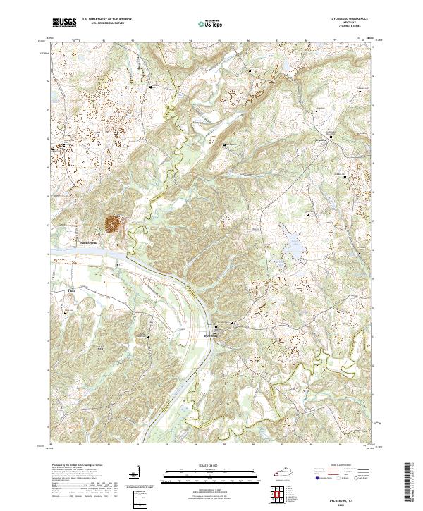
2022 Map of Dycusburg
USGS Topo · Published 2022About this map
Dycusburg and Pinckneyville sit at the center of this riverine landscape, where the Cumberland River forms a wide southern bend. The area is defined by its deep historical roots, with several small settlements such as Tiline and Frances connected by a network of local roads like Tiline Rd and Frances Rd. Genealogists will find a wealth of data points across the undulating terrain, from the Frances Presbyterian Church Cem in the northeast to Groves Chapel Cem and Asbridge Cem. The geography is characterized by numerous springs and hollows, including Harp Hollow Cr and Larping Spring, which drain into the main river channel. Distinctive landmarks like Whitt Bluff and Post Oak Ridge provide natural orientation points within the complex drainage systems of Claylick Cr and Livingston Cr.
Find a feature on this map
94 named features on this map. Tap any name to fly to it.
Don’t see what you’re looking for? This feature index may not catch every label — zoom into the map to look around manually.
Map Details
Editions of this 2022 Dycusburg Map
This is the sole edition of this map. No revisions or reprints were ever made.
Other maps of this area

1916 · Fords Ferry
USGS Topo · 1:62,500

1916 · Golconda
USGS Topo · 1:62,500

1920 · Goloonda
USGS Topo · 1:48,000

1921 · Fords Ferry
USGS Topo · 1:48,000

1921 · Golconda
USGS Topo · 1:62,500

1925 · Cave In Rock
USGS Topo · 1:62,500

1928 · Eddyville
USGS Topo · 1:48,000

1929 · Smithland
USGS Topo · 1:62,500

1931 · Eddyville
USGS Topo · 1:62,500

1936 · Eddyville
USGS Topo · 1:48,000