
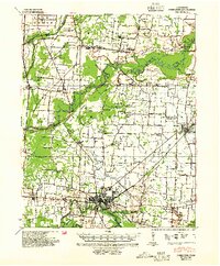
1939 Map of Dyersburg
USGS Topo · Published 1943About this map
The Obion River and North Fork Deer River systems dominate this West Tennessee landscape, revealing a region defined by its complex drainage and alluvial bottoms. The terrain transition is noted by an "entire escarpment not contoured" label, marking the edge of the floodplains where settlements like Dyersburg and Newbern established themselves on higher ground. The map captures a high density of rural social infrastructure, with numerous combined institutions such as Hopewell Ch & Sch and Hurricane Ch and Sch serving the farming communities.
Find a feature on this map
78 named features on this map. Tap any name to fly to it.
Don’t see what you’re looking for? This feature index may not catch every label — zoom into the map to look around manually.
Map Details
Editions of this 1939 Dyersburg Map
2 editions found
Other maps of this area

1925 · Reelfoot Lake
USGS Topo · 1:62,500

1939 · Reelfoot Lake
USGS Topo · 1:62,500

1939 · Portageville
USGS Topo · 1:62,500

1939 · Hales Point
USGS Topo · 1:62,500

1939 · Caruthersville
USGS Topo · 1:62,500

1939 · Halls
USGS Topo · 1:62,500

1950 · Obion
USGS Topo · 1:24,000

1951 · Obion
USGS Topo · 1:24,000

1951 · Caruthersville
USGS Topo · 1:62,500

1952 · Hales Point
USGS Topo · 1:62,500