
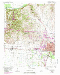
1952 Map of Dyersburg
USGS Topo · Published 1953About this map
Dyersburg serves as the focal point of this west Tennessee landscape, appearing here as it was during the post-war industrial and agricultural expansion of the early 1950s. The town's grid is anchored by the central Courthouse and Okeena Park, while the southern reaches show the development of South Dyersburg near the Dyersburg Municipal Airport. The Illinois Central railroad cuts through the terrain, connecting the urban center to outlying communities like Finley and Lenox.
Find a feature on this map
46 named features on this map. Tap any name to fly to it.
Don’t see what you’re looking for? This feature index may not catch every label — zoom into the map to look around manually.
Map Details
Editions of this 1952 Dyersburg Map
2 editions found
Other maps of this area

1939 · Dyersburg
USGS Topo · 1:62,500

1939 · Hales Point
USGS Topo · 1:62,500

1939 · Caruthersville
USGS Topo · 1:62,500

1939 · Halls
USGS Topo · 1:62,500

1951 · Caruthersville
USGS Topo · 1:62,500

1952 · Hales Point
USGS Topo · 1:62,500

1952 · Bonicord
USGS Topo · 1:24,000

1952 · Newbern
USGS Topo · 1:24,000

1952 · Lane
USGS Topo · 1:24,000

1952 · Miston
USGS Topo · 1:24,000