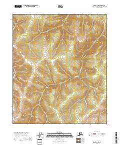
2018 Map of Eagle C-1 NW
USGS Topo · Published 2018About this map
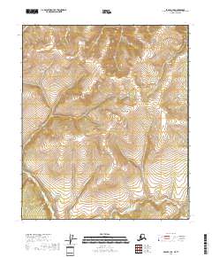
Nugget Gulch and Star Gulch sit at the center of this 2018 topographic study of the Southeast Fairbanks region, where the terrain is defined by an intricate network of drainage systems. The map traces the paths of American Cr and its major tributaries, including Teddys Fork and Discovery Fork. This area of the Yukon-Charley Rivers National Preserve vicinity is characterized by deep vertical relief and named gulches that suggest a history of prospecting and mineral interest in the creek beds. Other watercourses like Mission Cr, Cripple Cr, and Wolf Cr flow through the township and range lines of t2s r31e and t3s r32e, providing a clear look at the hydraulic patterns that shaped this interior Alaskan landscape.
Find a feature on this map
14 named features on this map. Tap any name to fly to it.
Don’t see what you’re looking for? This feature index may not catch every label — zoom into the map to look around manually.
Map Details
Editions of this 2018 Eagle C-1 NW Map
This is the sole edition of this map. No revisions or reprints were ever made.
Other maps of this area

1899 · Fortymile
USGS Topo · 1:250,000

1951 · Eagle
USGS Topo · 1:250,000

1956 · Eagle C-1
USGS Topo · 1:63,360

1956 · Eagle D-2
USGS Topo · 1:63,360

1956 · Eagle C-2
USGS Topo · 1:63,360
1956 · Eagle D-1
USGS Topo · 1:63,360

1957 · Eagle
USGS Topo · 1:250,000
2018 · Eagle D-2 SE
USGS Topo · 1:25,000
2018 · Eagle C-2 SE
USGS Topo · 1:25,000
2018 · Eagle C-1 SE
USGS Topo · 1:25,000