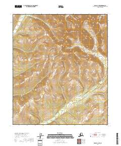
2018 Map of Eagle C-2 NW
USGS Topo · Published 2018About this map
Glacier Mtn dominates the high elevation terrain in this part of the Southeast Fairbanks Census Area, serving as a primary drainage divide for the surrounding valley systems. This 2018 topographic survey illustrates the steep, unpopulated landscape defined by a network of seasonal and perennial streams. To the west, the waters of Butte Cr descend from the ridges, while the eastern slopes feed into Comet Cr and Seward Cr. The map details the precise township and range boundaries of T2S R29E and T2S R30E, providing a modern look at a wilderness area where the natural topography remains the primary feature. The absence of roads or permanent structures reflects the isolated character of this subarctic landscape.
Find a feature on this map
9 named features on this map. Tap any name to fly to it.
Don’t see what you’re looking for? This feature index may not catch every label — zoom into the map to look around manually.
Map Details
Editions of this 2018 Eagle C-2 NW Map
This is the sole edition of this map. No revisions or reprints were ever made.
Other maps of this area

1899 · Fortymile
USGS Topo · 1:250,000

1951 · Eagle
USGS Topo · 1:250,000

1956 · Eagle D-2
USGS Topo · 1:63,360

1956 · Eagle C-2
USGS Topo · 1:63,360

1956 · Eagle D-3
USGS Topo · 1:63,360

1956 · Eagle C-3
USGS Topo · 1:63,360

1957 · Eagle
USGS Topo · 1:250,000
2018 · Eagle C-3 SE
USGS Topo · 1:25,000
2018 · Eagle D-2 SE
USGS Topo · 1:25,000
2018 · Eagle C-3 NE
USGS Topo · 1:25,000