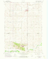
1963 Map of Eagle Center
USGS Topo · Published 1973About this map
Eagle Center serves as the focal point for this agrarian landscape in eastern Iowa, situated at a crossroad within Eagle township. The map captures a moment in the early 1960s where rural social life remained anchored by local institutions, notably the St Mary Sch and the Geneseo Ch. The topography is defined by the winding course of Wolf Creek in the south and the branching tributaries of Miller Creek and Mud Creek to the north, which carve gentle valleys through the prairie farmland.
Find a feature on this map
24 named features on this map. Tap any name to fly to it.
Don’t see what you’re looking for? This feature index may not catch every label — zoom into the map to look around manually.
Map Details
Editions of this 1963 Eagle Center Map
2 editions found
Other maps of this area

1954 · Waterloo
USGS Topo · 1:250,000

1955 · Waterloo
USGS Topo · 1:250,000

1963 · Buckingham
USGS Topo · 1:24,000

1963 · Hudson
USGS Topo · 1:24,000

1963 · Waterloo South
USGS Topo · 1:24,000

1963 · Eagle Center
USGS Topo · 1:24,000

1971 · Gilbertville
USGS Topo · 1:24,000
1971 · Dysart
USGS Topo · 1:24,000

1971 · La Porte City
USGS Topo · 1:24,000

1971 · Traer
USGS Topo · 1:24,000