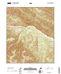
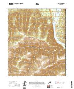
2018 Map of Eagle D-1 SW
USGS Topo · Published 2018About this map
Mission Creek and its complex network of tributaries dominate this portion of the Southeast Fairbanks Census Area. The drainage patterns of Mission Cr and American Cr define the high-latitude terrain, illustrating the hydrologic flow through a landscape largely shaped by seasonal water movement and elevation. The map details a series of smaller waterways, including Wolf Cr and Colorado Cr, which converge to feed the larger systems. This 2018 survey provides an essential view of the watershed as it appeared in the early 21st century, showing how drainages like Excelsior Cr and Lost Cr carve through the land. The absence of built infrastructure on the map highlights the wilderness character of this region, where topographic relief and watercourses are the primary identifiers for navigation and land use.
Find a feature on this map
15 named features on this map. Tap any name to fly to it.
Don’t see what you’re looking for? This feature index may not catch every label — zoom into the map to look around manually.
Map Details
Editions of this 2018 Eagle D-1 SW Map
This is the sole edition of this map. No revisions or reprints were ever made.
Other maps of this area

1899 · Fortymile
USGS Topo · 1:250,000

1951 · Eagle
USGS Topo · 1:250,000

1956 · Eagle C-1
USGS Topo · 1:63,360

1956 · Eagle D-2
USGS Topo · 1:63,360

1956 · Eagle C-2
USGS Topo · 1:63,360
1956 · Eagle D-1
USGS Topo · 1:63,360

1957 · Eagle
USGS Topo · 1:250,000
2018 · Eagle D-2 SE
USGS Topo · 1:25,000
2018 · Eagle C-2 NE
USGS Topo · 1:25,000
2018 · Eagle C-1 NE
USGS Topo · 1:25,000