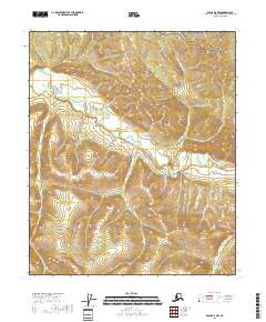
2018 Map of Eagle D-2 NW
USGS Topo · Published 2018About this map
The Seventymile River cuts through this portion of the Yukon-Charley Rivers National Preserve, a landscape defined by its network of steep drainage basins and gold-bearing tributaries. In the northern reaches, the terrain descends toward Barney Cr and Little Washington Cr, while the southern half is dominated by the winding path of the river as it collects water from Canyon Cr, Sonickson Cr, and Gold Cr. The map's detail provides a clear view of the complex topography of the Southeast Fairbanks Census Area, where narrow valleys like those of Mogul Cr and Ruby Cr illustrate the drainage patterns essential to the region's historic mining activity. Without roads or settlements, the map reveals a wilderness area organized primarily by its watersheds and the public land survey system divisions of t2n r28e and t1n r29e.
Find a feature on this map
15 named features on this map. Tap any name to fly to it.
Don’t see what you’re looking for? This feature index may not catch every label — zoom into the map to look around manually.
Map Details
Editions of this 2018 Eagle D-2 NW Map
This is the sole edition of this map. No revisions or reprints were ever made.
Other maps of this area

1899 · Fortymile
USGS Topo · 1:250,000

1951 · Charley River
USGS Topo · 1:250,000

1951 · Eagle
USGS Topo · 1:250,000

1956 · Charley River A-3
USGS Topo · 1:63,360

1956 · Charley River A-2
USGS Topo · 1:63,360

1956 · Charley River
USGS Topo · 1:250,000

1956 · Eagle D-2
USGS Topo · 1:63,360

1956 · Eagle D-3
USGS Topo · 1:63,360

1957 · Eagle
USGS Topo · 1:250,000
2018 · Charley River A-2 SE
USGS Topo · 1:25,000