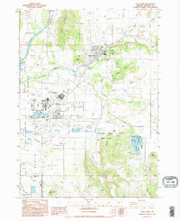
1983 Map of Eagle Point
USGS Topo · Published 1995About this map
Eagle Point serves as the focal point of this valley landscape, where the urban development of White City and the Veterans Administration Domiciliary meet the agricultural and wild lands of Jackson County. The terrain transitions from the open Agate Desert to the Rader Hills, marked by a sophisticated water management system including the Medford Aqueduct, various canals, and a series of siphons. This infrastructure supports the region's movement from the banks of the Rogue River toward the storage at Agate Reservoir.
Find a feature on this map
42 named features on this map. Tap any name to fly to it.
Don’t see what you’re looking for? This feature index may not catch every label — zoom into the map to look around manually.
Map Details
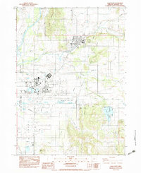
Editions of this 1983 Eagle Point Map
2 editions found
Other maps of this area

1891 · Ashland
USGS Topo · 1:250,000

1893 · Ashland
USGS Topo · 1:250,000

1897 · Ashland
USGS Topo · 1:250,000

1938 · Medford
USGS Topo · 1:125,000

1943 · Trail
USGS Topo · 1:62,500

1954 · Medford
USGS Topo · 1:62,500

1954 · Butte Falls
USGS Topo · 1:62,500

1954 · Lakecreek
USGS Topo · 1:62,500

1955 · Medford
USGS Topo · 1:250,000

1957 · Medford
USGS Topo · 1:250,000