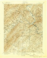
1915 Map of Eagle Rock
USGS Topo · Published 1945About this map
Richpatch Mine and the iron industry define the landscape of this region during the early twentieth century. The map reveals a transition from active extraction to industrial decay, marking the remains of Grace Furnace and Salisbury Furnace along the valley floors. The Chesapeake and Ohio RR follows the bends of the James River, connecting essential stops like Eagle Mountain Sta and Gala to the broader regional economy. Away from the river, a dense network of one-room schools serves the mountain communities, including the Bearwallow School and Mountain Valley School. The terrain is characterized by long, parallel ridges like Patterson Mountain and Richpatch Mountain, which shaped the paths of early roads and rail lines. Notable social landmarks include the Fairgrounds near Fincastle and the Daggers Springs resort area, illustrating the dual nature of the era's mountain life between hard industry and seasonal recreation.
Find a feature on this map
102 named features on this map. Tap any name to fly to it.
Don’t see what you’re looking for? This feature index may not catch every label — zoom into the map to look around manually.
Map Details
Editions of this 1915 Eagle Rock Map
3 editions found
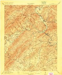
Other maps of this area

1887 · Lewisburg
USGS Topo · 1:125,000

1890 · Roanoke
USGS Topo · 1:125,000

1890 · Christiansburg
USGS Topo · 1:125,000

1891 · Roanoke
USGS Topo · 1:125,000

1891 · Lewisburg
USGS Topo · 1:125,000

1894 · Natural Bridge
USGS Topo · 1:125,000

1894 · Natural Bridge
USGS Topo · 1:62,500

1907 · Natural Bridge Special
USGS Topo · 1:62,500

1913 · Eagle Rock
USGS Topo · 1:48,000

1915 · Eagle Rock
USGS Topo · 1:62,500