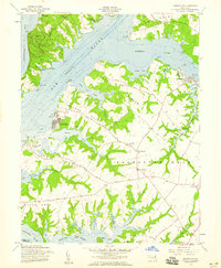
1958 Map of Earleville
USGS Topo · Published 1959About this map
The waters of the Chesapeake Bay and the Elk River define this peninsula in the late 1950s, a landscape shaped by narrow necks of land and quiet inlets. Coastal settlements like Crystal Beach and West View Shores sit along the western banks, while the interior is anchored by the communities of Earleville and Cecilton. The geography is characterized by prominent ridges such as Pearce Neck and Veazey Neck, which separate the various creeks feeding into the Sassafras River and Bohemia River. Local history is visible through scattered landmarks including St Stephens Ch, St Pauls Ch, and the Veazey Cem. In the north, Elk Neck State Park and Camp Chesapeake represent the recreational use of the shorelines, while the Project Depth 26 Feet 1957 label on the Elk River indicates the vital shipping lanes maintained during this era.
Find a feature on this map
69 named features on this map. Tap any name to fly to it.
Don’t see what you’re looking for? This feature index may not catch every label — zoom into the map to look around manually.
Map Details
Editions of this 1958 Earleville Map
2 editions found
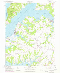
Other maps of this area

1898 · Elkton
USGS Topo · 1:62,500

1898 · Tolchester
USGS Topo · 1:125,000

1899 · Dover
USGS Topo · 1:125,000

1900 · Elkton
USGS Topo · 1:62,500

1900 · Cecilton
USGS Topo · 1:62,500

1900 · Havre De Grace
USGS Topo · 1:62,500

1900 · Betterton
USGS Topo · 1:62,500

1903 · Tolchester
USGS Topo · 1:125,000

1906 · Dover
USGS Topo · 1:125,000

1908 · Tolchester
USGS Topo · 1:125,000