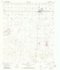
1963 Map of Earth
USGS Topo · Published 1981About this map
Earth and the surrounding high plains of Lamb County are defined by a network of agricultural water wells and infrastructure in this mid-century survey. The landscape is dominated by the broad, shallow depression of Blackwater Draw, which meanders across the territory alongside several industrial features. Local recreation and services are represented by a Drive-in Theater and Memorial Cem on the outskirts of the town site, while the Power Plant and a series of Sandpits indicate the local utility and resource extraction of the era. The presence of the Halsell Ranch and Spring Lake highlight the legacy of cattle ranching and natural water sources in this region. This revision, which includes purple-ink updates from 1979, traces the development of rural utility lines and pipelines that supported the growing community.
Find a feature on this map
16 named features on this map. Tap any name to fly to it.
Don’t see what you’re looking for? This feature index may not catch every label — zoom into the map to look around manually.
Map Details
Editions of this 1963 Earth Map
2 editions found
Other maps of this area

1954 · Clovis
USGS Topo · 1:250,000

1958 · Clovis
USGS Topo · 1:250,000

1962 · Amherst
USGS Topo · 1:24,000

1962 · Sudan
USGS Topo · 1:24,000

1962 · Muleshoe NE
USGS Topo · 1:24,000

1962 · Cofferville
USGS Topo · 1:24,000

1962 · Springlake
USGS Topo · 1:24,000

1963 · Earth
USGS Topo · 1:24,000

1963 · Dodd SE
USGS Topo · 1:24,000

1963 · Dodd
USGS Topo · 1:24,000