
1972 Map of Easby
USGS Topo · Published 1975About this map
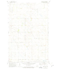
Easby sits at a rail junction in Cavalier County during the early 1970s, serving as a quiet focal point in this section of the Red River Valley upland. The Burlington Northern railroad cuts diagonally through the townships of Manilla and Easby, illustrating the historical importance of the rail line to the local agricultural economy. The landscape is defined by its sectional grid, punctuated by scattered Gravel Pits and utility infrastructure like the Radio Tower Substation. Small, unnamed water bodies and a local Cem reflect the sparse, functional layout of the prairie. This survey captures the region just before significant modern agricultural shifts, documenting the precise footprints of farmsteads and field boundaries across the townships of Elgin, Perry, and Osnabrock.
Find a feature on this map
12 named features on this map. Tap any name to fly to it.
Don’t see what you’re looking for? This feature index may not catch every label — zoom into the map to look around manually.
Map Details
Editions of this 1972 Easby Map
This is the sole edition of this map. No revisions or reprints were ever made.
Other maps of this area

1953 · Devils Lake
USGS Topo · 1:250,000

1956 · Devils Lake
USGS Topo · 1:250,000

1967 · Langdon East
USGS Topo · 1:24,000

1969 · Olga SW
USGS Topo · 1:24,000

1970 · Langdon West
USGS Topo · 1:24,000

1972 · Osnabrock
USGS Topo · 1:24,000

1972 · Nekoma
USGS Topo · 1:24,000

1972 · Osnabrock SW
USGS Topo · 1:24,000

1972 · Billings Lake
USGS Topo · 1:24,000
1972 · Nekoma NW
USGS Topo · 1:24,000