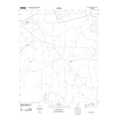
2011 Map of East Camden
USGS Topo · Published 2011About this map
The Locust Bayou Oil Field serves as a central industrial anchor in this southern Arkansas landscape, where the petroleum economy meets the complex hydrology of the West Gulf Coastal Plain. Scattered settlements like East Camden, Lakeside, and Locust Bayou are connected by a network of rural routes, including HWY 274 and County HWY-2, which navigate around extensive wetlands and water bodies. The terrain is defined by the winding paths of Two Bayou, Dogwood Creek, and the Locust Bayou waterway, which drain toward the south into Big Johnson Lake. For local historians and genealogists, the inclusion of Furr Cemetery and Plunkett Cemetery provides specific points of interest for tracing family roots in Ouachita County. The map also highlights the importance of timber and natural resources in the region, evidenced by labels such as Potlatch Rd, reflecting the intersection of industrial land use and the natural environment.
Find a feature on this map
49 named features on this map. Tap any name to fly to it.
Don’t see what you’re looking for? This feature index may not catch every label — zoom into the map to look around manually.
Map Details
Editions of this 2011 East Camden Map
This is the sole edition of this map. No revisions or reprints were ever made.
Other maps of this area

1903 · Camden
USGS Topo · 1:125,000

1951 · Camden
USGS Topo · 1:24,000

1953 · El Dorado
USGS Topo · 1:250,000

1957 · El Dorado
USGS Topo · 1:250,000

1958 · El Dorado
USGS Topo · 1:250,000

1960 · El Dorado
USGS Topo · 1:250,000

1962 · Louann
USGS Topo · 1:24,000

1962 · Smackover NE
USGS Topo · 1:24,000

1962 · Snow Hill
USGS Topo · 1:24,000

1964 · Smackover
USGS Topo · 1:62,500