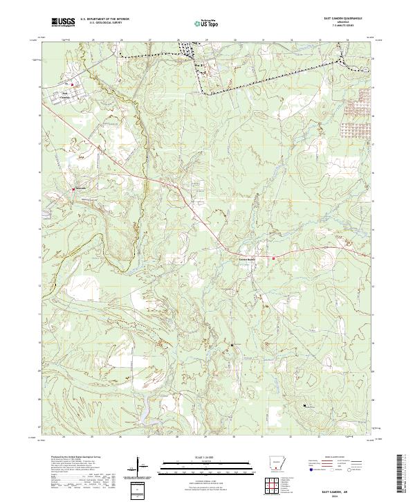
2024 Map of East Camden
USGS Topo · Published 2024About this map
East Camden anchors the northwestern corner of this Arkansas landscape, where a dense network of streets like Hussey Rd and Ingram St meets the rural boundary between Quachita Co and Calhoun Co. The terrain transitions into a mosaic of wetlands and timberland, shaped by the meandering courses of Two Bayou and Locust Bayou. Small settlements and landmarks are scattered throughout this watershed, including Lakeside and the community of Locust Bayou, which sits near the junction of several county routes.
Find a feature on this map
63 named features on this map. Tap any name to fly to it.
Don’t see what you’re looking for? This feature index may not catch every label — zoom into the map to look around manually.
Map Details
Editions of this 2024 East Camden Map
This is the sole edition of this map. No revisions or reprints were ever made.
Other maps of this area

1903 · Camden
USGS Topo · 1:125,000

1951 · Camden
USGS Topo · 1:24,000

1953 · El Dorado
USGS Topo · 1:250,000

1957 · El Dorado
USGS Topo · 1:250,000

1958 · El Dorado
USGS Topo · 1:250,000

1960 · El Dorado
USGS Topo · 1:250,000

1962 · Louann
USGS Topo · 1:24,000

1962 · Smackover NE
USGS Topo · 1:24,000

1962 · Snow Hill
USGS Topo · 1:24,000

1964 · Smackover
USGS Topo · 1:62,500