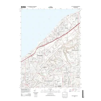
2013 Map of East Cleveland
USGS Topo · Published 2013About this map
Lake Erie defines the northern coastline of this highly urbanized portion of Cuyahoga County, where the dense street grids of Cleveland and East Cleveland meet the residential developments of Euclid and Cleveland Heights. The map highlights a significant cultural and educational corridor, anchored by Case Western Reserve Univ, the Cleveland Institute of Art, and the Cleveland Institute of Music.
Find a feature on this map
55 named features on this map. Tap any name to fly to it.
Don’t see what you’re looking for? This feature index may not catch every label — zoom into the map to look around manually.
Map Details
Editions of this 2013 East Cleveland Map
This is the sole edition of this map. No revisions or reprints were ever made.
Other maps of this area

1901 · Euclid
USGS Topo · 1:62,500

1903 · Cleveland
USGS Topo · 1:62,500

1903 · Euclid
USGS Topo · 1:62,500

1905 · Mentor
USGS Topo · 1:62,500

1906 · Chagrin Falls
USGS Topo · 1:62,500

1907 · Mentor
USGS Topo · 1:62,500

1908 · Chagrin Falls
USGS Topo · 1:62,500

1950 · Cleveland
USGS Topo · 1:250,000

1953 · Chagrin Falls
USGS Topo · 1:24,000

1953 · Shaker Heights
USGS Topo · 1:24,000