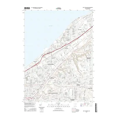
2016 Map of East Cleveland
USGS Topo · Published 2016About this map
Lake Erie defines the northern edge of this densely developed shoreline, where the industrial and residential corridors of Cleveland and Euclid meet. The map reveals a landscape shaped by education and healthcare institutions, anchored by the sprawling campus of Case Western Reserve University and the Cleveland Clinic - School of Diagnostic Imaging. Urban expansion is evident in the layout of historic neighborhoods like Collinwood, Glenville, and Nottingham, which are bisected by major thoroughfares such as Lakeshore Blvd and Euclid Ave.
Find a feature on this map
48 named features on this map. Tap any name to fly to it.
Don’t see what you’re looking for? This feature index may not catch every label — zoom into the map to look around manually.
Map Details
Editions of this 2016 East Cleveland Map
This is the sole edition of this map. No revisions or reprints were ever made.
Other maps of this area

1901 · Euclid
USGS Topo · 1:62,500

1903 · Cleveland
USGS Topo · 1:62,500

1903 · Euclid
USGS Topo · 1:62,500

1905 · Mentor
USGS Topo · 1:62,500

1906 · Chagrin Falls
USGS Topo · 1:62,500

1907 · Mentor
USGS Topo · 1:62,500

1908 · Chagrin Falls
USGS Topo · 1:62,500

1950 · Cleveland
USGS Topo · 1:250,000

1953 · Chagrin Falls
USGS Topo · 1:24,000

1953 · Shaker Heights
USGS Topo · 1:24,000