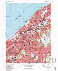
1994 Map of East Cleveland
USGS Topo · Published 1997About this map
The dense urban and industrial landscape of eastern Cleveland and its immediate suburbs is defined by the massive rail infrastructure of the Conrail network and the sprawling Collinwood Yard. Established within the Connecticut Western Reserve, this area shows the complex mid-century growth patterns of Euclid, Cleveland Heights, and South Euclid. The map documents a mature educational and institutional corridor, anchored by Case Western Reserve University and Notre Dame College, alongside numerous parochial schools such as St Josephs High Sch.
Find a feature on this map
72 named features on this map. Tap any name to fly to it.
Don’t see what you’re looking for? This feature index may not catch every label — zoom into the map to look around manually.
Map Details
Editions of this 1994 East Cleveland Map
This is the sole edition of this map. No revisions or reprints were ever made.
Other maps of this area

1901 · Euclid
USGS Topo · 1:62,500

1903 · Cleveland
USGS Topo · 1:62,500

1903 · Euclid
USGS Topo · 1:62,500

1905 · Mentor
USGS Topo · 1:62,500

1906 · Chagrin Falls
USGS Topo · 1:62,500

1907 · Mentor
USGS Topo · 1:62,500

1908 · Chagrin Falls
USGS Topo · 1:62,500

1950 · Cleveland
USGS Topo · 1:250,000

1953 · Chagrin Falls
USGS Topo · 1:24,000

1953 · Shaker Heights
USGS Topo · 1:24,000