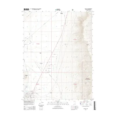
2014 Map of East Ely
USGS Topo · Published 2014About this map
Steptoe Valley dominates the central landscape of this survey, flanked by the rising peaks of the Duck Creek Range to the east. The map captures the infrastructure of East Ely, where the town's grid transitions into the industrial zones of N Industrial Way and S Industrial Way. Regional aviation history is centered at Ely Airport/Yelland Field, while the area's mining and milling heritage is represented by the Baltimore Mill near Lackawanna Springs. The eastern portion of the map climbs into the protected lands of the Humboldt National Forest, showcasing a stark contrast between the developed valley floor and the high-elevation wilderness. Numerous water sources, including Ely Warm Springs and Steptoe Spring, dot the terrain, indicating the vital importance of natural springs in this high-desert environment near the settlements of Lavon and Mosier.
Find a feature on this map
54 named features on this map. Tap any name to fly to it.
Don’t see what you’re looking for? This feature index may not catch every label — zoom into the map to look around manually.
Map Details
Editions of this 2014 East Ely Map
This is the sole edition of this map. No revisions or reprints were ever made.
Other maps of this area

1952 · Ely
USGS Topo · 1:125,000

1956 · Ely
USGS Topo · 1:250,000

1958 · McGill
USGS Topo · 1:24,000

1958 · Ruth
USGS Topo · 1:24,000

1958 · East Ely
USGS Topo · 1:24,000

1958 · Comins Lake
USGS Topo · 1:24,000

1958 · Ely
USGS Topo · 1:62,500

1958 · McGill
USGS Topo · 1:62,500

1958 · Ely
USGS Topo · 1:24,000

1959 · Ely
USGS Topo · 1:250,000