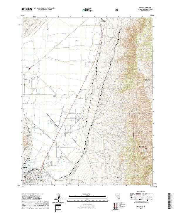
2021 Map of East Ely
USGS Topo · Published 2021About this map
Steptoe Valley forms the central corridor of this Nevada landscape, where the town of East Ely and the neighborhood of Calumet meet the southern edge of the desert basin. The industrial and transportation history of White Pine County is evident in the presence of the Baltimore Mill and the expansive infrastructure of Ely Airport / Yelland Field. These features reflect the region's reliance on mining and mineral processing, while the surrounding grid of local roads like McGill Rd and Airport Rd connects scattered settlements such as Mosier and Lavon.
Find a feature on this map
64 named features on this map. Tap any name to fly to it.
Don’t see what you’re looking for? This feature index may not catch every label — zoom into the map to look around manually.
Map Details
Editions of this 2021 East Ely Map
This is the sole edition of this map. No revisions or reprints were ever made.
Other maps of this area

1952 · Ely
USGS Topo · 1:125,000

1956 · Ely
USGS Topo · 1:250,000

1958 · McGill
USGS Topo · 1:24,000

1958 · Ruth
USGS Topo · 1:24,000

1958 · East Ely
USGS Topo · 1:24,000

1958 · Comins Lake
USGS Topo · 1:24,000

1958 · Ely
USGS Topo · 1:62,500

1958 · McGill
USGS Topo · 1:62,500

1958 · Ely
USGS Topo · 1:24,000

1959 · Ely
USGS Topo · 1:250,000