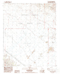
1988 Map of East of Acolita
USGS Topo · Published 1988About this map
The Chocolate Mountains dominate the northern landscape of this Imperial County region, where the terrain transitions into a designated Aerial Gunnery Range. This military designation characterizes the mid-section of the map, situated north of the sweeping Algodones Sand Dunes that define the southwest corner. The area serves as a corridor for industrial infrastructure, evidenced by a prominent Pipeline, an associated Dike, and a Pumping Station. Resource extraction is a secondary theme here, with several Gravel Pit sites and various Prospect markers scattered across the bajada and foothills. The network of 4wd tracks suggests a remote desert environment primarily utilized for military training and utility maintenance in the late 1980s.
Find a feature on this map
17 named features on this map. Tap any name to fly to it.
Don’t see what you’re looking for? This feature index may not catch every label — zoom into the map to look around manually.
Map Details
Editions of this 1988 East of Acolita Map
2 editions found
Other maps of this area

1903 · Yuma
USGS Topo · 1:125,000

1905 · Yuma
USGS Topo · 1:125,000

1907 · Holtville
USGS Topo · 1:125,000

1942 · El Centro
USGS Topo · 1:250,000

1942 · Yuma
USGS Topo · 1:250,000

1942 · Blythe
USGS Topo · 1:250,000

1953 · Quartz Peak
USGS Topo · 1:62,500

1953 · Ogilby
USGS Topo · 1:62,500

1953 · Acolita
USGS Topo · 1:24,000

1953 · Acolita
USGS Topo · 1:62,500