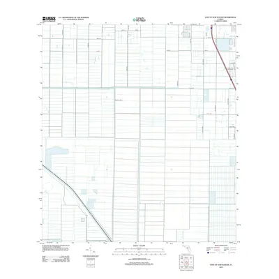
2012 Map of East of Gum Slough
USGS Topo · Published 2012About this map
Agricultural grids and aviation facilities define this landscape in Saint Lucie County, located east of Gum Slough. The terrain is dominated by a systematic network of drainage canals and access roads, including 146th Ave and 150th Ave, which service the large-scale citrus groves or farming blocks typical of this region. Aviation is a prominent feature of the local infrastructure, with the Indian River Aerodrome positioned in the northeast and the Marsh Airstrip located centrally. The eastern edge of the map shows the transition toward more residential development, marked by the circular street patterns of W Villa Cir and E Villa Cir. This survey captures the intensive land management required for Florida's interior coastal plains, where water control and transportation are critical for the local economy.
Find a feature on this map
25 named features on this map. Tap any name to fly to it.
Don’t see what you’re looking for? This feature index may not catch every label — zoom into the map to look around manually.
Map Details
Editions of this 2012 East of Gum Slough Map
This is the sole edition of this map. No revisions or reprints were ever made.
Other maps of this area

1949 · Vero Beach
USGS Topo · 1:24,000

1949 · Oslo
USGS Topo · 1:24,000

1949 · Fort Pierce NW
USGS Topo · 1:24,000

1950 · Fort Pierce NW
USGS Topo · 1:24,000

1950 · Oslo
USGS Topo · 1:24,000

1950 · Vero Beach
USGS Topo · 1:24,000

1953 · Fellsmere 4 SE
USGS Topo · 1:24,000

1953 · Fellsmere 4 SW
USGS Topo · 1:24,000

1953 · Fellsmere 4 NW
USGS Topo · 1:24,000

1953 · Okeechobee 1 NE
USGS Topo · 1:24,000