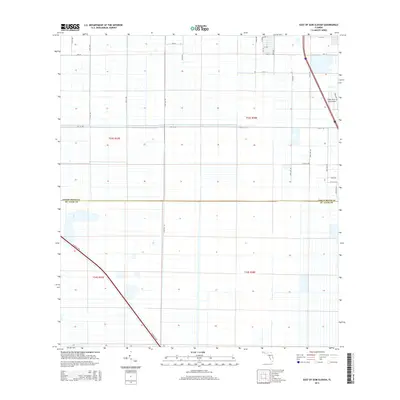
2015 Map of East of Gum Slough
USGS Topo · Published 2015About this map
The Indian River Co St. Lucie Co line defines the central axis of this landscape, where the agricultural grid of south Florida meets modern infrastructure. To the northwest, the terrain is partitioned by a meticulous network of section lines and access roads like 150th Ave and 130th Ave, while the southeast is dominated by the diagonal path of Florida's Tpke. A distinctive hub of activity is visible at the Indian River Aerodrome, situated near the eastern edge alongside residential developments such as W Verona Cir and La Cir. This 2015 survey illustrates the transition from rural land management to suburban expansion, evidenced by the named streets like Nieuport Dr that break the rigid township and range system of t33s r38e.
Find a feature on this map
31 named features on this map. Tap any name to fly to it.
Don’t see what you’re looking for? This feature index may not catch every label — zoom into the map to look around manually.
Map Details
Editions of this 2015 East of Gum Slough Map
This is the sole edition of this map. No revisions or reprints were ever made.
Other maps of this area

1949 · Vero Beach
USGS Topo · 1:24,000

1949 · Oslo
USGS Topo · 1:24,000

1949 · Fort Pierce NW
USGS Topo · 1:24,000

1950 · Fort Pierce NW
USGS Topo · 1:24,000

1950 · Oslo
USGS Topo · 1:24,000

1950 · Vero Beach
USGS Topo · 1:24,000

1953 · Fellsmere 4 SE
USGS Topo · 1:24,000

1953 · Fellsmere 4 SW
USGS Topo · 1:24,000

1953 · Fellsmere 4 NW
USGS Topo · 1:24,000

1953 · Okeechobee 1 NE
USGS Topo · 1:24,000