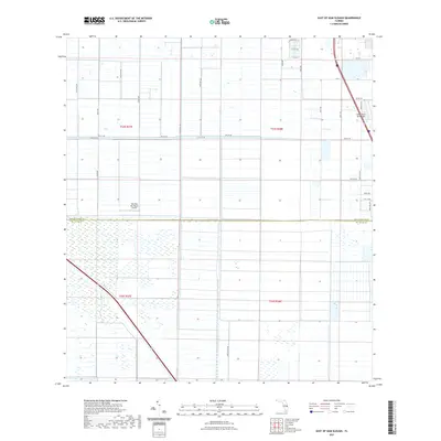
2021 Map of East of Gum Slough
USGS Topo · Published 2021About this map
Agricultural grids and aviation clearings define this section of the Florida landscape along the border of Indian River Co and St. Lucie Co. The map reveals a highly structured environment of drainage and access, where long corridors like 150th Ave SW and Minute Maid Rd cut through the wetlands and citrus groves of the Treasure Coast hinterlands. Aviation history and private flight are central to this area, anchored by the Wee Bee Sky Ranch Airport and the Indian River Aerodrome, which is accessed via the appropriately named Sopwith Dr. This 2021 survey documents the persistent rural character of these townships, showing the intersection of large-scale land management and small private airstrips that serves as a transition between the coastal developments to the east and the interior marshes.
Find a feature on this map
30 named features on this map. Tap any name to fly to it.
Don’t see what you’re looking for? This feature index may not catch every label — zoom into the map to look around manually.
Map Details
Editions of this 2021 East of Gum Slough Map
This is the sole edition of this map. No revisions or reprints were ever made.
Other maps of this area

1949 · Vero Beach
USGS Topo · 1:24,000

1949 · Oslo
USGS Topo · 1:24,000

1949 · Fort Pierce NW
USGS Topo · 1:24,000

1950 · Fort Pierce NW
USGS Topo · 1:24,000

1950 · Oslo
USGS Topo · 1:24,000

1950 · Vero Beach
USGS Topo · 1:24,000

1953 · Fellsmere 4 SE
USGS Topo · 1:24,000

1953 · Fellsmere 4 SW
USGS Topo · 1:24,000

1953 · Fellsmere 4 NW
USGS Topo · 1:24,000

1953 · Okeechobee 1 NE
USGS Topo · 1:24,000