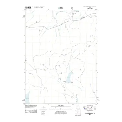
2011 Map of East Park Reservoir
USGS Topo · Published 2011About this map
East Park Reservoir and its associated East Park Dam anchor this high-elevation landscape in Uintah County, where water management and recreational infrastructure shape the terrain. This 2011 survey illustrates a network of mountain meadows designated as "Parks," such as Lonesome Park, Brush Park, and Dyer Park, which suggest a long history of seasonal grazing or early settlement camps. The map detail is particularly useful for tracing forest access via early Forest Service routes like FS Rd 13 and FS 694 Rd. Numerous hydrological features including Aztec Spring, Skull Creek, and the headwaters of Little Brush Creek indicate the importance of this watershed for the surrounding region. Established recreation sites like Greens Lakes Campground and Skull Creek Campground reflect the area's transition into a modern forest destination.
Find a feature on this map
81 named features on this map. Tap any name to fly to it.
Don’t see what you’re looking for? This feature index may not catch every label — zoom into the map to look around manually.
Map Details
Editions of this 2011 East Park Reservoir Map
This is the sole edition of this map. No revisions or reprints were ever made.
Other maps of this area

1885 · Ashley
USGS Topo · 1:250,000

1906 · Marsh Peak
USGS Topo · 1:125,000

1908 · Marsh Peak
USGS Topo · 1:125,000

1950 · Burnt Cabin Gorge
USGS Topo · 1:24,000

1950 · Dyer Mountain
USGS Topo · 1:24,000

1952 · Dutch John Mtn
USGS Topo · 1:24,000

1952 · Flaming Gorge
USGS Topo · 1:24,000

1954 · Vernal
USGS Topo · 1:250,000

1958 · Vernal
USGS Topo · 1:250,000

1960 · Vernal
USGS Topo · 1:250,000