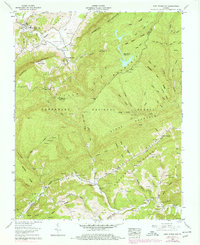
1957 Map of East Stone Gap
USGS Topo · Published 1978About this map
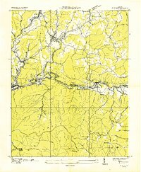
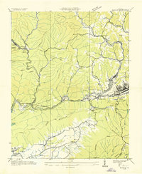
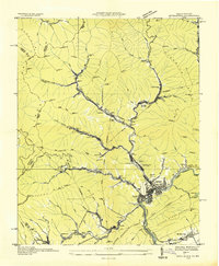
East Stone Gap sits at the foot of Powell Mountain, where the valley landscape is defined by a dense network of family cemeteries and rural congregations. This 1957 record, based on fieldwork from the mid-1950s with later updates, reveals a deep genealogical layer including the Gilly Cem, Dickenson Cem, and Barker Cem. The map highlights the transition between the agricultural valley and the managed timberlands of the Jefferson National Forest. Notable infrastructure like the Powell Valley Airport and the Southern railway line underscore the area's mid-century connectivity, while the presence of a Strip mine and the Big Cherry Reservoir indicate the industrial and resource-driven activities that shaped this portion of Wise and Scott counties. Small communities such as Stanleytown and Mabe appear linked by a network of churches, including Durham Chapel and Midway Ch.
Find a feature on this map
95 named features on this map. Tap any name to fly to it.
Don’t see what you’re looking for? This feature index may not catch every label — zoom into the map to look around manually.
Map Details
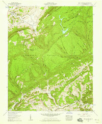
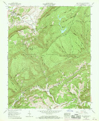
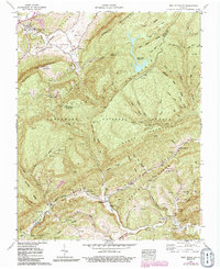
Editions of this 1957 East Stone Gap Map
4 editions found
Other maps of this area

1894 · Estillville
USGS Topo · 1:125,000

1920 · Wise
USGS Topo · 1:48,000

1921 · Big Stone Gap
USGS Topo · 1:48,000

1921 · Wise
USGS Topo · 1:62,500

1922 · Big Stone Gap
USGS Topo · 1:62,500

1929 · Big Stone Gap
USGS Topo · 1:62,500
1935 · Wise
USGS Topo · 1:24,000

1935 · Moggasin
USGS Topo · 1:48,000
1935 · Norton
USGS Topo · 1:24,000
1935 · Appalachia
USGS Topo · 1:24,000