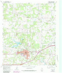
1966 Map of Eastland
USGS Topo · Published 1987About this map
The Oil Field landscape of Central Texas is prominently displayed in this mid-1960s survey, with updates from the early 1980s. The town of Eastland serves as the regional hub, situated near the confluence of the North Fork Leon River and the South Fork Leon River. The local infrastructure reflects a deep connection to petroleum and transportation, shown through the Missouri Pacific rail line and numerous pumping stations, including the Lone Star Pumping Station.
Find a feature on this map
32 named features on this map. Tap any name to fly to it.
Don’t see what you’re looking for? This feature index may not catch every label — zoom into the map to look around manually.
Map Details
Editions of this 1966 Eastland Map
2 editions found
Other maps of this area

1890 · Breckenridge
USGS Topo · 1:125,000

1894 · Eastland
USGS Topo · 1:125,000

1954 · Abilene
USGS Topo · 1:250,000

1958 · Abilene
USGS Topo · 1:250,000

1966 · Cisco North
USGS Topo · 1:24,000

1966 · Kokomo
USGS Topo · 1:24,000

1966 · Carbon
USGS Topo · 1:24,000

1966 · Eastland
USGS Topo · 1:24,000

1966 · Cisco South
USGS Topo · 1:24,000

1966 · Ranger
USGS Topo · 1:24,000