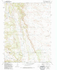
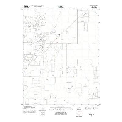
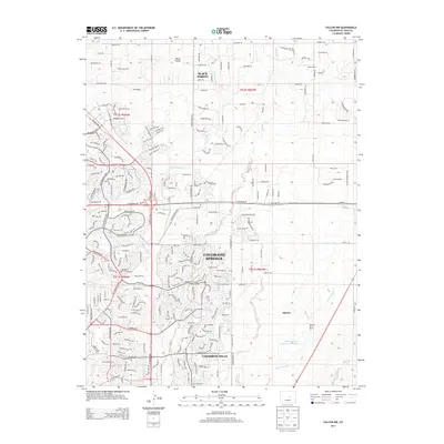
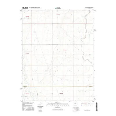
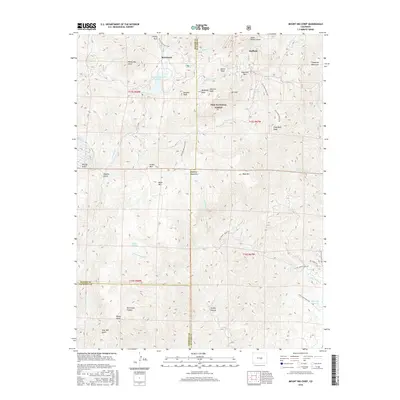
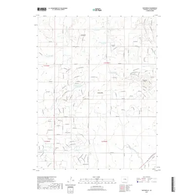
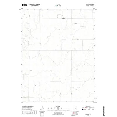
1954 Map of Eastonville
USGS Topo · Published 1978About this map
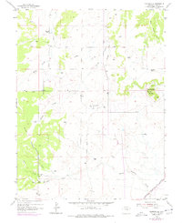
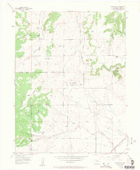
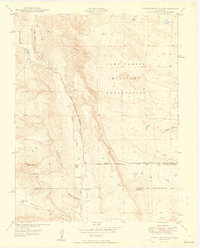
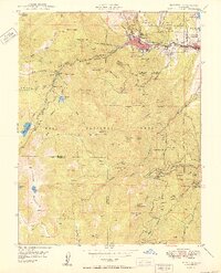
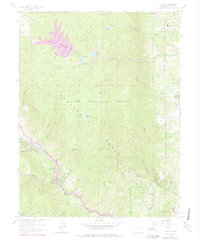
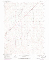
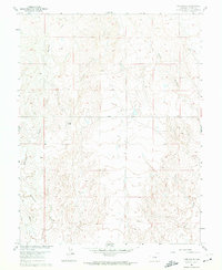
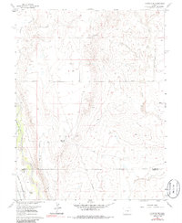
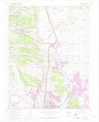
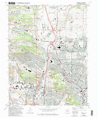
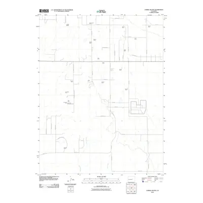
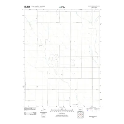
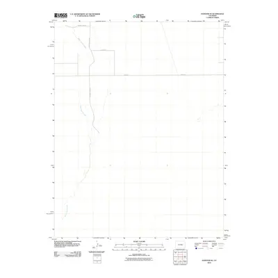
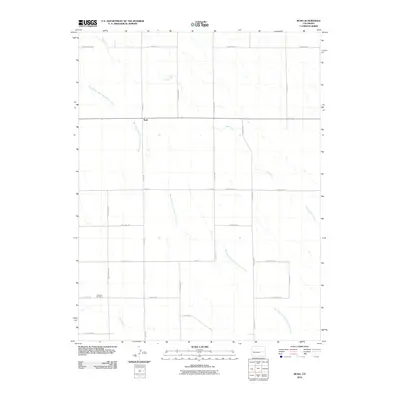
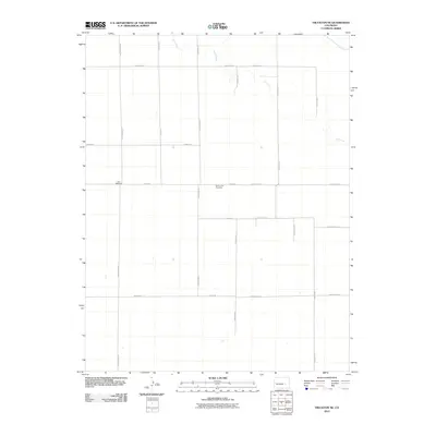
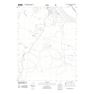
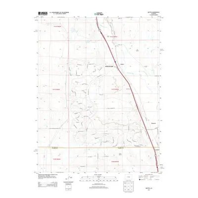
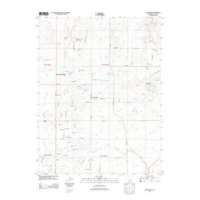
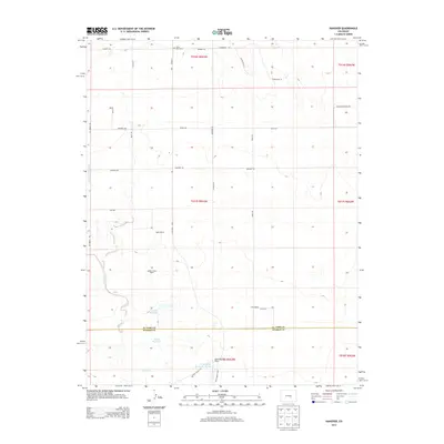
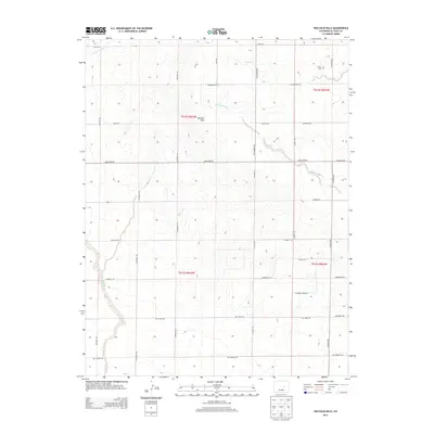
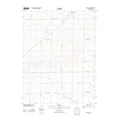
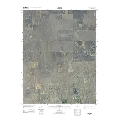
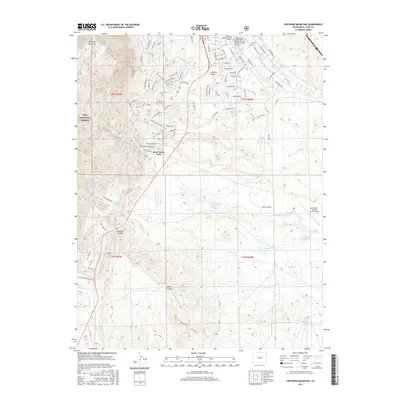
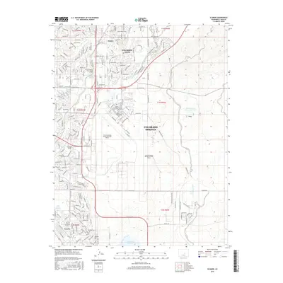
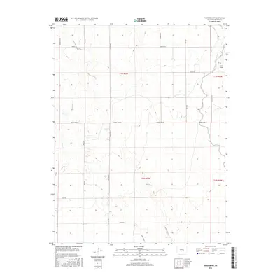
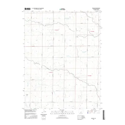
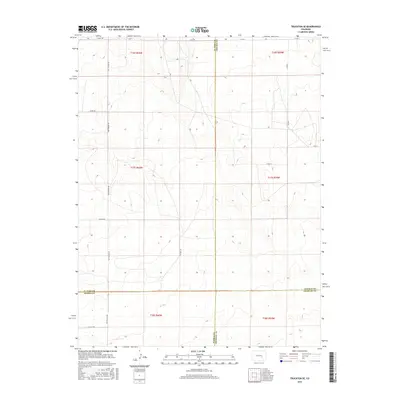
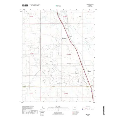
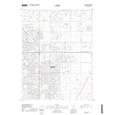
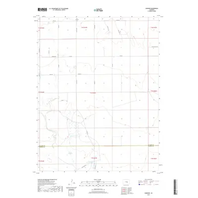
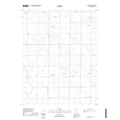
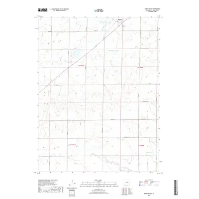
Eastonville sits as the central settlement in this high-plains landscape, where the headwaters of several prominent regional creeks begin their descent. Surveyed in 1954 with later revisions, the map reveals a ranching economy defined by family-named holdings like Pine Park Ranch and Ayer Ranch. A significant geographic feature is the Old Railroad Grade, which bisects the terrain alongside an existing route of the Chicago Rock Island and Pacific railroad, illustrating the shift in transportation corridors over time. In the northeast, the prominent Rattlesnake Butte stands as a distinct landmark overlooking the drainage of West Bijou Creek. For genealogists, the Eastonville Cem and a smaller unnamed Cem provide specific points of interest for tracing local family history in this corner of El Paso County.
Find a feature on this map
15 named features on this map. Tap any name to fly to it.
Don’t see what you’re looking for? This feature index may not catch every label — zoom into the map to look around manually.
Map Details
Editions of this 1954 Eastonville Map
6 editions found
Historical Maps of Eastonville Through Time
209 maps found

1893 Big Springs
El Paso County, CO
1948 Cascade
El Paso County, CO

1948 Cheyenne Mountain
El Paso County, CO

1948 Falcon
El Paso County, CO

1948 Falcon
El Paso County, CO

1948 Falcon NW
El Paso County, CO

1948 Fountain SE
El Paso County, CO
1948 Mount Big Chief
El Paso County, CO

1948 Mount Big Chief
El Paso County, CO

1948 Pikeview
El Paso County, CO

1948 Timber Mountain
El Paso County, CO

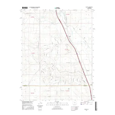
1949 Buttes
El Paso County, CO

1949 Cheyenne Mountain
El Paso County, CO

1949 Corral Bluffs
El Paso County, CO

1949 Mount Big Chief
El Paso County, CO

1949 Pikeview
El Paso County, CO
1949 Timber Mountain
El Paso County, CO

1950 Cascade
El Paso County, CO
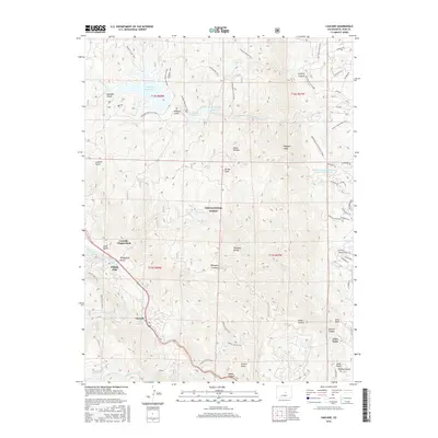
1950 Elsmere
El Paso County, CO
1950 Falcon NW
El Paso County, CO

1950 Fountain NE
El Paso County, CO
1950 Fountain SE
El Paso County, CO
1950 Manitou
El Paso County, CO

1951 Falcon
El Paso County, CO

1951 Mount Big Chief
El Paso County, CO
1954 Eastonville
El Paso County, CO
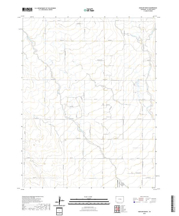
1954 Haegler Ranch
El Paso County, CO
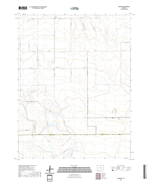
1954 Hanover
El Paso County, CO
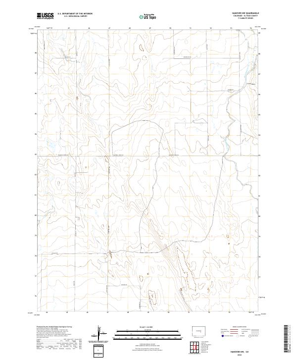
1954 Hanover NW
El Paso County, CO

1961 Buttes
El Paso County, CO
1961 Cascade
El Paso County, CO
1961 Cheyenne Mountain
El Paso County, CO
1961 Corral Bluffs
El Paso County, CO
1961 Elsmere
El Paso County, CO
1961 Falcon
El Paso County, CO

1961 Falcon NW
El Paso County, CO
1961 Fountain NE
El Paso County, CO
1961 Fountain SE
El Paso County, CO

1961 Mount Big Chief
El Paso County, CO
1961 Pikeview
El Paso County, CO
1961 Timber Mountain
El Paso County, CO
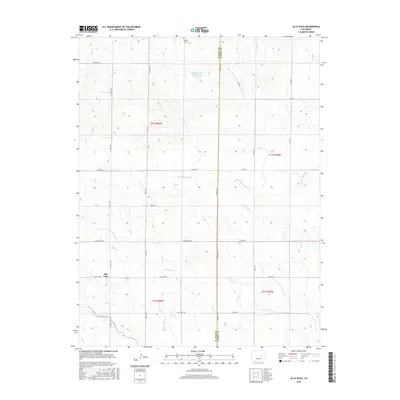
1970 Alta Vista
El Paso County, CO

1970 Ramah South
El Paso County, CO

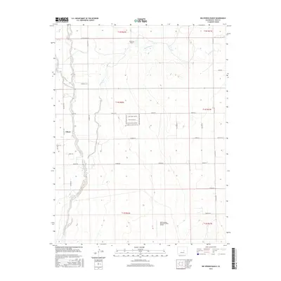
1973 Big Springs Ranch
El Paso County, CO

1973 Edison School
El Paso County, CO

1973 Hanover NE
El Paso County, CO

1973 Hanover SE
El Paso County, CO

1973 Holcolm Hills
El Paso County, CO

1973 Holtwold Store
El Paso County, CO

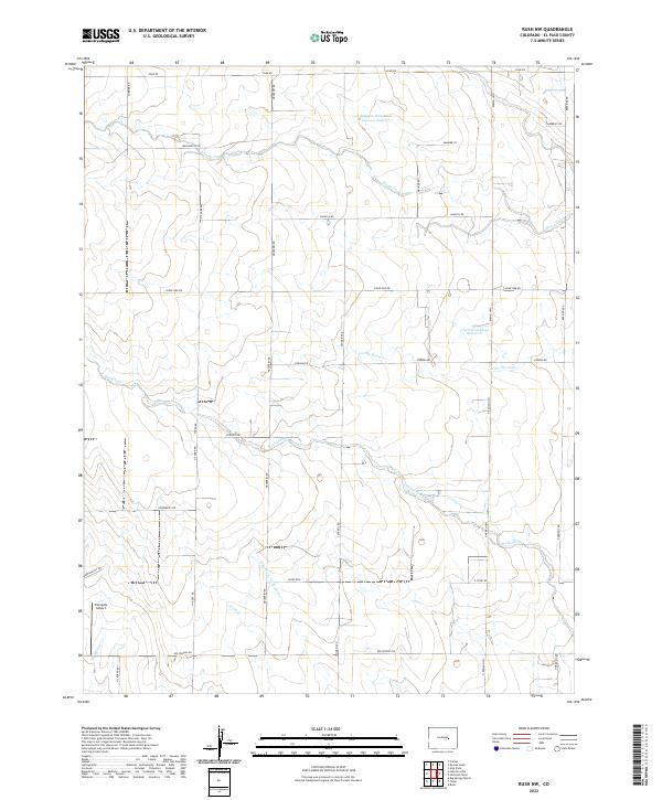
1973 Rush
El Paso County, CO

1973 Rush NW
El Paso County, CO

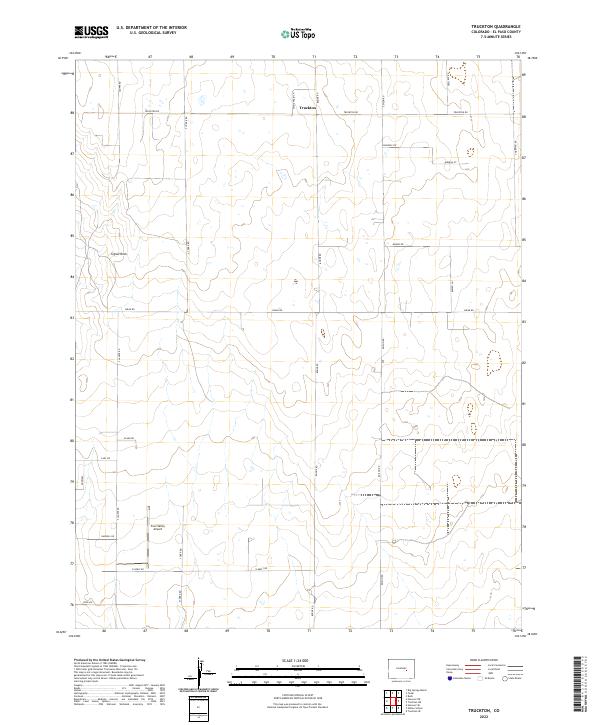
1973 Truckton
El Paso County, CO
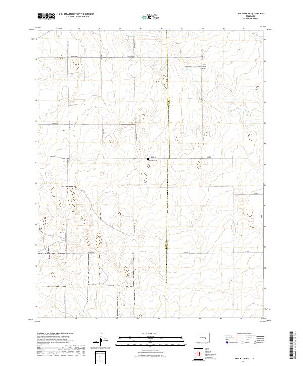
1973 Truckton NE
El Paso County, CO

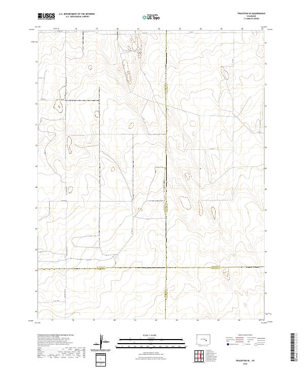
1973 Truckton SE
El Paso County, CO

1973 Yoder
El Paso County, CO
1986 Cascade
El Paso County, CO
1986 Pikeview
El Paso County, CO

1994 Cascade
El Paso County, CO

1994 Mount Big Chief
El Paso County, CO
2010 Alta Vista
El Paso County, CO
2010 Big Springs Ranch
El Paso County, CO
2010 Buttes
El Paso County, CO
2010 Corral Bluffs
El Paso County, CO
2010 Eastonville
El Paso County, CO
2010 Edison School
El Paso County, CO
2010 Elsmere
El Paso County, CO
2010 Falcon
El Paso County, CO
2010 Falcon NW
El Paso County, CO
2010 Fountain NE
El Paso County, CO
2010 Fountain SE
El Paso County, CO
2010 Haegler Ranch
El Paso County, CO
2010 Hanover
El Paso County, CO
2010 Hanover NE
El Paso County, CO
2010 Hanover NW
El Paso County, CO
2010 Hanover SE
El Paso County, CO
2010 Holcolm Hills
El Paso County, CO
2010 Holtwold Store
El Paso County, CO

2010 Pikeview
El Paso County, CO
2010 Ramah South
El Paso County, CO
2010 Rush
El Paso County, CO
2010 Rush NW
El Paso County, CO
2010 Timber Mountain
El Paso County, CO
2010 Truckton
El Paso County, CO
2010 Truckton NE
El Paso County, CO
2010 Truckton SE
El Paso County, CO
2010 Yoder
El Paso County, CO
2011 Cascade
El Paso County, CO
2011 Cheyenne Mountain
El Paso County, CO
2011 Mount Big Chief
El Paso County, CO
2013 Alta Vista
El Paso County, CO
2013 Big Springs Ranch
El Paso County, CO
2013 Buttes
El Paso County, CO
2013 Cascade
El Paso County, CO
2013 Cheyenne Mountain
El Paso County, CO
2013 Corral Bluffs
El Paso County, CO
2013 Eastonville
El Paso County, CO
2013 Edison School
El Paso County, CO
2013 Elsmere
El Paso County, CO
2013 Falcon
El Paso County, CO
2013 Falcon NW
El Paso County, CO
2013 Fountain NE
El Paso County, CO
2013 Fountain SE
El Paso County, CO
2013 Haegler Ranch
El Paso County, CO
2013 Hanover
El Paso County, CO
2013 Hanover NE
El Paso County, CO
2013 Hanover NW
El Paso County, CO
2013 Hanover SE
El Paso County, CO
2013 Holcolm Hills
El Paso County, CO
2013 Holtwold Store
El Paso County, CO
2013 Mount Big Chief
El Paso County, CO
2013 Pikeview
El Paso County, CO
2013 Ramah South
El Paso County, CO
2013 Rush
El Paso County, CO
2013 Rush NW
El Paso County, CO
2013 Timber Mountain
El Paso County, CO
2013 Truckton
El Paso County, CO
2013 Truckton NE
El Paso County, CO
2013 Truckton SE
El Paso County, CO
2013 Yoder
El Paso County, CO
2016 Alta Vista
El Paso County, CO
2016 Big Springs Ranch
El Paso County, CO
2016 Buttes
El Paso County, CO
2016 Cascade
El Paso County, CO
2016 Cheyenne Mountain
El Paso County, CO
2016 Corral Bluffs
El Paso County, CO
2016 Eastonville
El Paso County, CO
2016 Edison School
El Paso County, CO
2016 Elsmere
El Paso County, CO
2016 Falcon
El Paso County, CO
2016 Falcon NW
El Paso County, CO
2016 Fountain NE
El Paso County, CO
2016 Fountain SE
El Paso County, CO
2016 Haegler Ranch
El Paso County, CO
2016 Hanover
El Paso County, CO
2016 Hanover NE
El Paso County, CO
2016 Hanover NW
El Paso County, CO
2016 Hanover SE
El Paso County, CO
2016 Holcolm Hills
El Paso County, CO
2016 Holtwold Store
El Paso County, CO
2016 Mount Big Chief
El Paso County, CO
2016 Pikeview
El Paso County, CO
2016 Ramah South
El Paso County, CO
2016 Rush
El Paso County, CO
2016 Rush NW
El Paso County, CO
2016 Timber Mountain
El Paso County, CO
2016 Truckton
El Paso County, CO
2016 Truckton NE
El Paso County, CO
2016 Truckton SE
El Paso County, CO
2016 Yoder
El Paso County, CO
2019 Alta Vista
El Paso County, CO
2019 Big Springs Ranch
El Paso County, CO
2019 Buttes
El Paso County, CO
2019 Cascade
El Paso County, CO
2019 Cheyenne Mountain
El Paso County, CO
2019 Corral Bluffs
El Paso County, CO
2019 Eastonville
El Paso County, CO
2019 Edison School
El Paso County, CO
2019 Elsmere
El Paso County, CO
2019 Falcon
El Paso County, CO
2019 Falcon NW
El Paso County, CO
2019 Fountain NE
El Paso County, CO
2019 Fountain SE
El Paso County, CO
2019 Haegler Ranch
El Paso County, CO
2019 Hanover
El Paso County, CO
2019 Hanover NE
El Paso County, CO
2019 Hanover NW
El Paso County, CO
2019 Hanover SE
El Paso County, CO
2019 Holcolm Hills
El Paso County, CO
2019 Holtwold Store
El Paso County, CO
2019 Mount Big Chief
El Paso County, CO
2019 Pikeview
El Paso County, CO
2019 Ramah South
El Paso County, CO
2019 Rush
El Paso County, CO
2019 Rush NW
El Paso County, CO
2019 Timber Mountain
El Paso County, CO
2019 Truckton
El Paso County, CO
2019 Truckton NE
El Paso County, CO
2019 Truckton SE
El Paso County, CO
2019 Yoder
El Paso County, CO
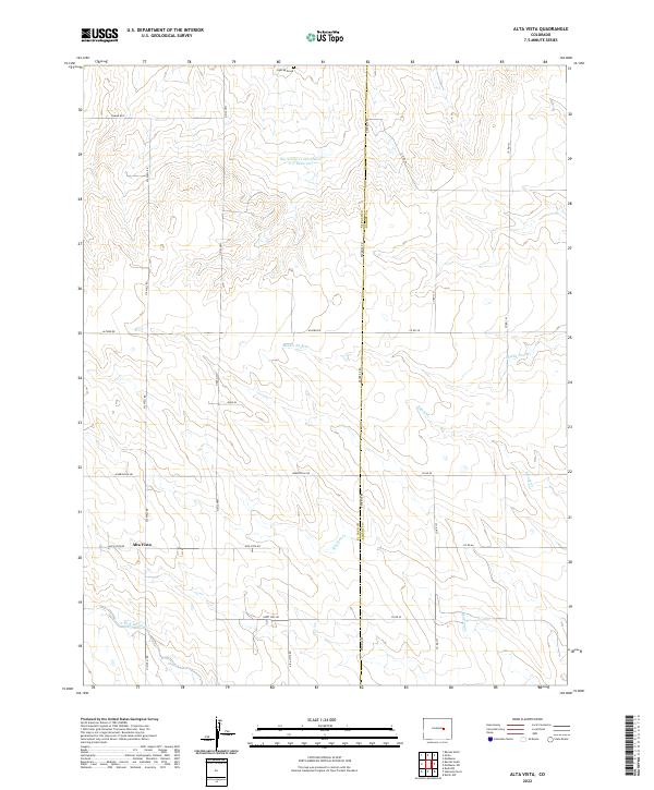
2022 Alta Vista
El Paso County, CO
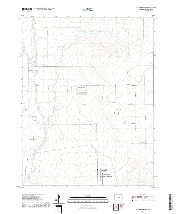
2022 Big Springs Ranch
El Paso County, CO
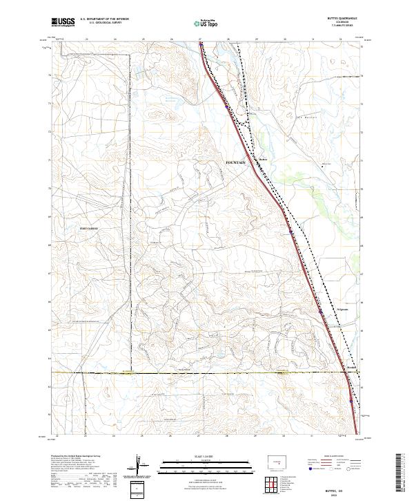
2022 Buttes
El Paso County, CO
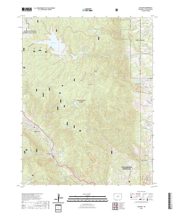
2022 Cascade
El Paso County, CO
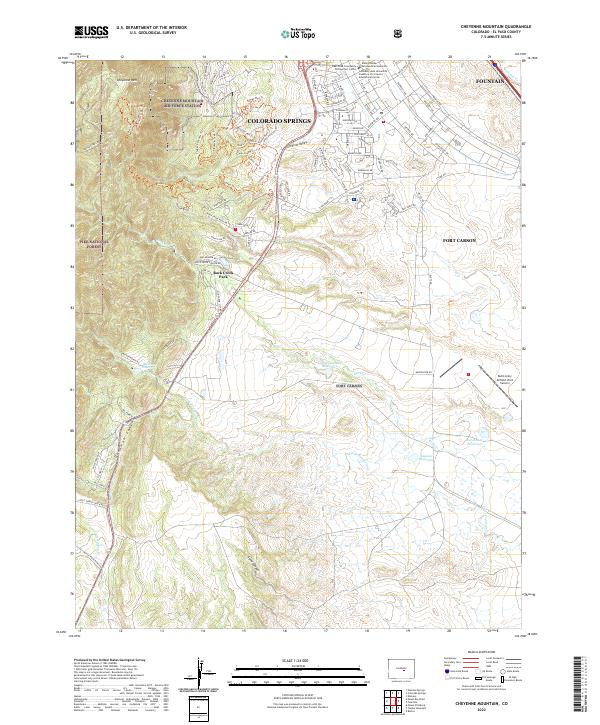
2022 Cheyenne Mountain
El Paso County, CO
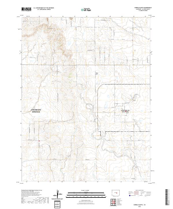
2022 Corral Bluffs
El Paso County, CO
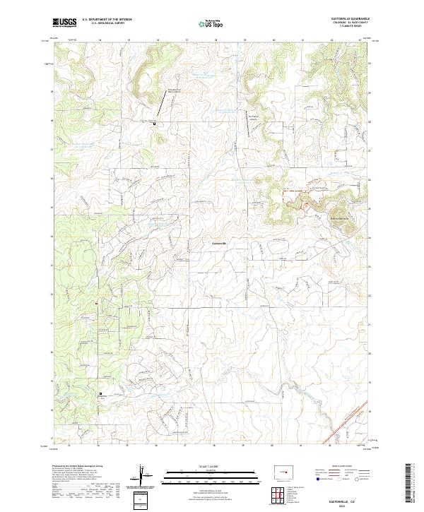
2022 Eastonville
El Paso County, CO
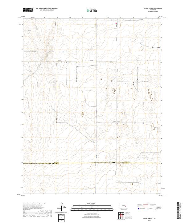
2022 Edison School
El Paso County, CO
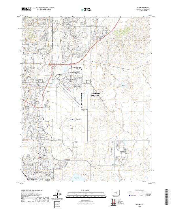
2022 Elsmere
El Paso County, CO
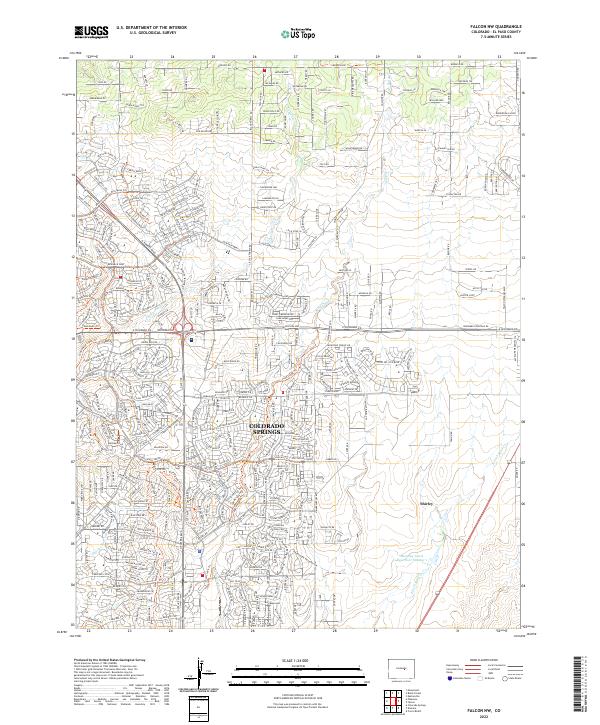
2022 Falcon NW
El Paso County, CO
2022 Fountain NE
El Paso County, CO
2022 Fountain SE
El Paso County, CO
2022 Haegler Ranch
El Paso County, CO
2022 Hanover
El Paso County, CO
2022 Hanover NE
El Paso County, CO
2022 Hanover NW
El Paso County, CO
2022 Hanover SE
El Paso County, CO
2022 Holcolm Hills
El Paso County, CO
2022 Holtwold Store
El Paso County, CO

2022 Mount Big Chief
El Paso County, CO

2022 Ramah South
El Paso County, CO
2022 Rush
El Paso County, CO
2022 Rush NW
El Paso County, CO

2022 Timber Mountain
El Paso County, CO
2022 Truckton
El Paso County, CO
2022 Truckton NE
El Paso County, CO
2022 Truckton SE
El Paso County, CO
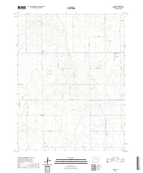
2022 Yoder
El Paso County, CO
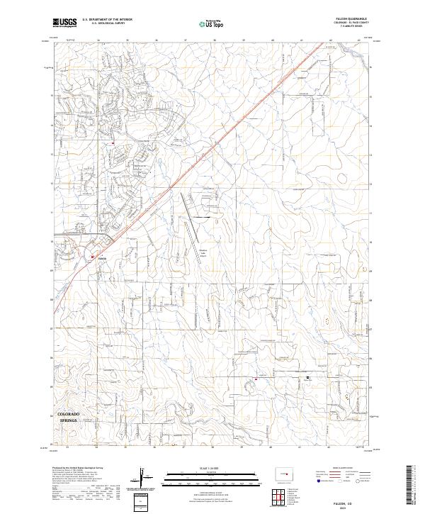
2023 Falcon
El Paso County, CO
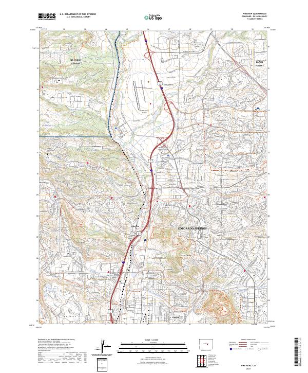
2023 Pikeview
El Paso County, CO