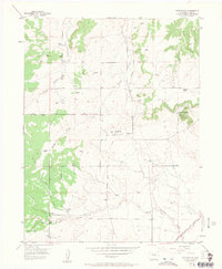
1954 Map of Eastonville
USGS Topo · Published 1963About this map
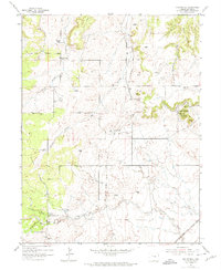
Eastonville sits at the heart of this high-plains landscape, where the agricultural and ranching heritage of El Paso County is clearly etched into the terrain. The map documents a transition in transportation, showing the Chicago Rock Island and Pacific tracks in the southeast while an Old Railroad Grade winds north through the center, marking the path of a previous rail era. Significant family holdings and landmarks like the Pine Park Ranch, Pine View Ranch, and Ayer Ranch suggest a community defined by large-scale land use and livestock. To the west, the dense timber of the Black Forest provides a sharp contrast to the open drainage basins of Kiowa Creek and Black Squirrel Creek. Rising above the surrounding plains, the prominent Rattlesnake Butte serves as a natural beacon in the eastern portion of the quadrangle, while scattered windmills indicate the vital importance of groundwater for these remote homesteads and ranches.
Find a feature on this map
17 named features on this map. Tap any name to fly to it.
Don’t see what you’re looking for? This feature index may not catch every label — zoom into the map to look around manually.
Map Details
Editions of this 1954 Eastonville Map
6 editions found
Other maps of this area

1893 · Big Springs
USGS Topo · 1:125,000

1893 · Colorado Springs
USGS Topo · 1:125,000

1894 · Castle Rock
USGS Topo · 1:125,000

1909 · Colorado Springs
USGS Topo · 1:125,000

1913 · Castle Rock
USGS Topo · 1:125,000

1940 · Elbert
USGS Topo · 1:62,500

1942 · Colorado Springs
USGS Topo · 1:125,000

1944 · Elbert
USGS Topo · 1:62,500

1948 · Falcon
USGS Topo · 1:24,000

1948 · Falcon
USGS Topo · 1:62,500