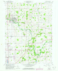
1960 Map of Eaton
USGS Topo · Published 1982About this map
The Mississinewa River carves a winding path through this portion of Delaware County, defining the rural landscape between Eaton and Albany. As of the mid-twentieth century, the region remained primarily agricultural, supported by the Norfolk and Western Railway corridor that links settlements like Shideler and Royerton. A heavy concentration of burial sites and small country sanctuaries, such as Union Ch and Delaware Chapel, suggests a long-established community structure deeply tied to local churchyards including Leaird Cem and Godlove Cem.
Find a feature on this map
40 named features on this map. Tap any name to fly to it.
Don’t see what you’re looking for? This feature index may not catch every label — zoom into the map to look around manually.
Map Details
Editions of this 1960 Eaton Map
3 editions found
Other maps of this area

1952 · Muncie East
USGS Topo · 1:24,000

1952 · Farmland
USGS Topo · 1:24,000

1952 · Muncie West
USGS Topo · 1:24,000

1953 · Muncie
USGS Topo · 1:250,000

1956 · Muncie
USGS Topo · 1:250,000

1960 · Pennville
USGS Topo · 1:24,000

1960 · Hartford City East
USGS Topo · 1:24,000

1960 · Eaton
USGS Topo · 1:24,000

1960 · Wheeling
USGS Topo · 1:24,000
1960 · Redkey
USGS Topo · 1:24,000